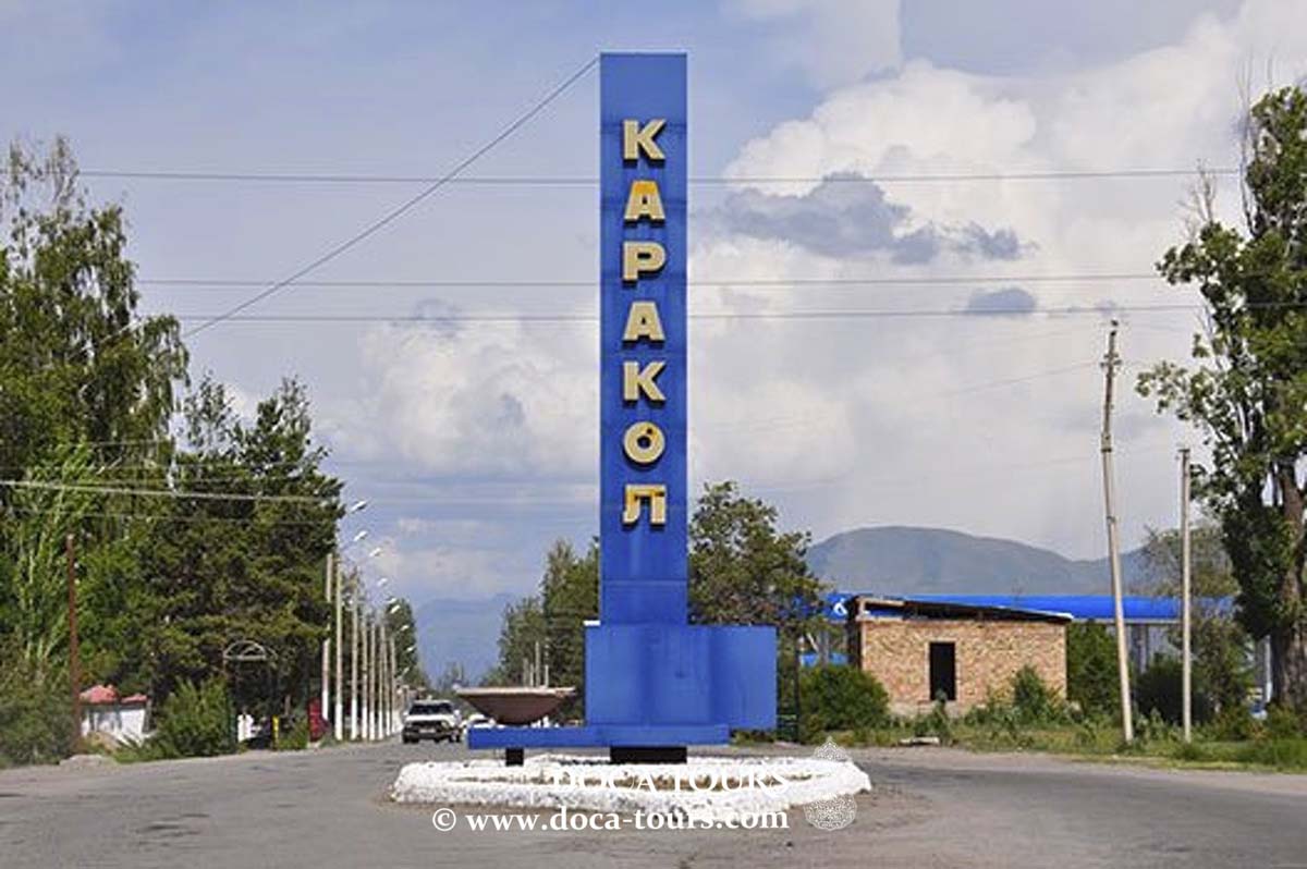
KARAKOL
- Geographical coordinates: 42°29′25″N 78°23′30″E
- Elevation: 1,745 m
- Common Languages: Kyrgyz, Russian
- Ethnic Groups: Kyrgyz, Dungans, Kalmyks, Russians, Uyghurs, Uzbeks etc.
- Population: 84,351 (2021)
- Time Zone: UTC + 6
- Telephone Code: +996-3922
- Postal Codes: 722200
- Vehicle Registration Code: 01
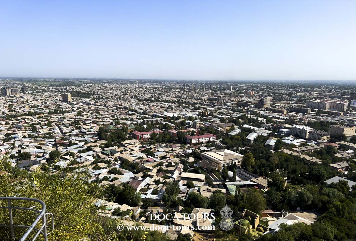
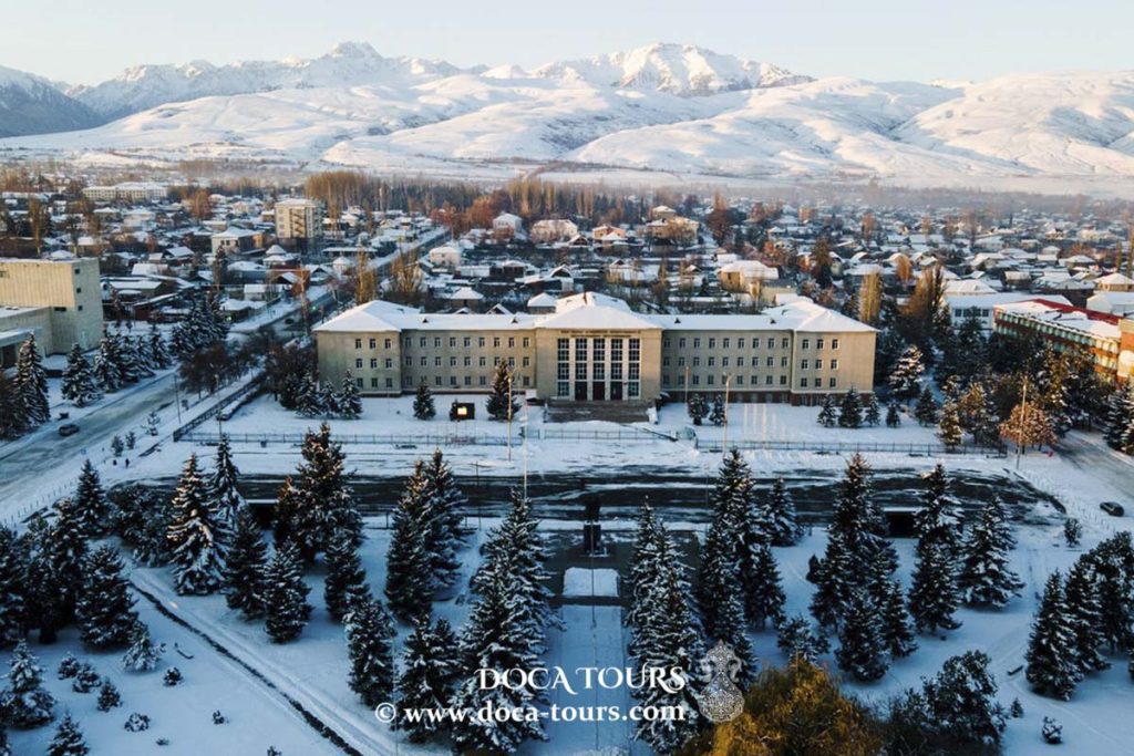
Karakol (Kyrgyz: Каракол, known as Przhevalsk from 1889–1922 and 1939–1992) is the fourth-largest city in Kyrgyzstan and serves as the administrative center of Issyk-Kul Region. It lies near the eastern end of Lake Issyk-Kul, approximately 150 km from the Kyrgyz-Chinese border and 380 km from the capital, Bishkek, at an altitude ranging from 1,690 to 1,850 meters above sea level.

The city covers an area of 52.53 km² and had a population of 81,952 as of early 2023, according to estimates by the National Statistical Committee of the Kyrgyz Republic (including the settlement of Pristan-Przhevalsk). To the north, along the EM-09 highway, is the town of Tyup, while the Jeti-Oguz resort lies to the southwest.
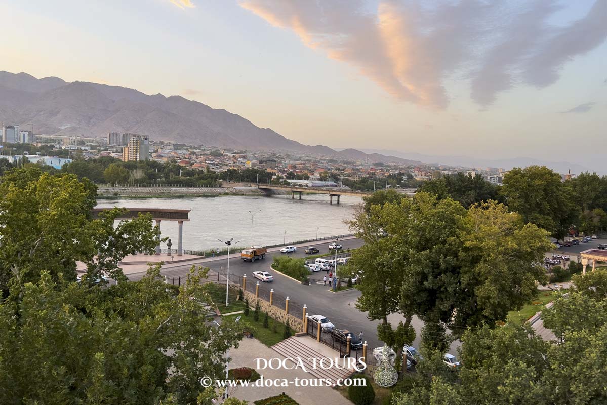
Located in the eastern part of Issyk-Kul Region, Karakol sits at the foot of the Terskey Ala-Too mountain range in the lower reaches of the Karakol River. It is 12 km from the shore of Lake Issyk-Kul, 400 km from Bishkek, and 220 km by road (or 184 km by water) from the nearest railway station in Balykchy.
Tourism and Attractions
Karakol attracts tourists and mountaineers with its stunning mountain landscapes. Notable sites near the city include the Jeti-Oguz ("Seven Bulls") and Jyluu-Suu ("Warm Water") resorts, located 30 km west along the southern shore of Issyk-Kul. To the east, 10 km away, is the Jerge-Tal balneotherapy resort, and 50 km further in the Tian Shan foothills lies the glacial Lake Merzbacher, which serves as a starting point for trekking to the Khan Tengri mountain base camp.
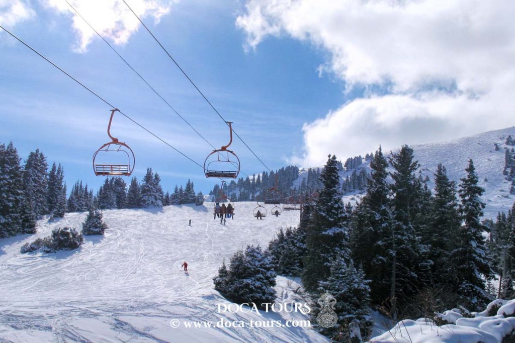
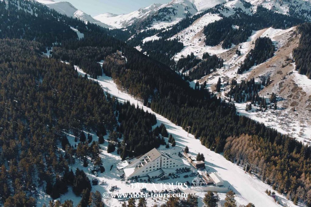
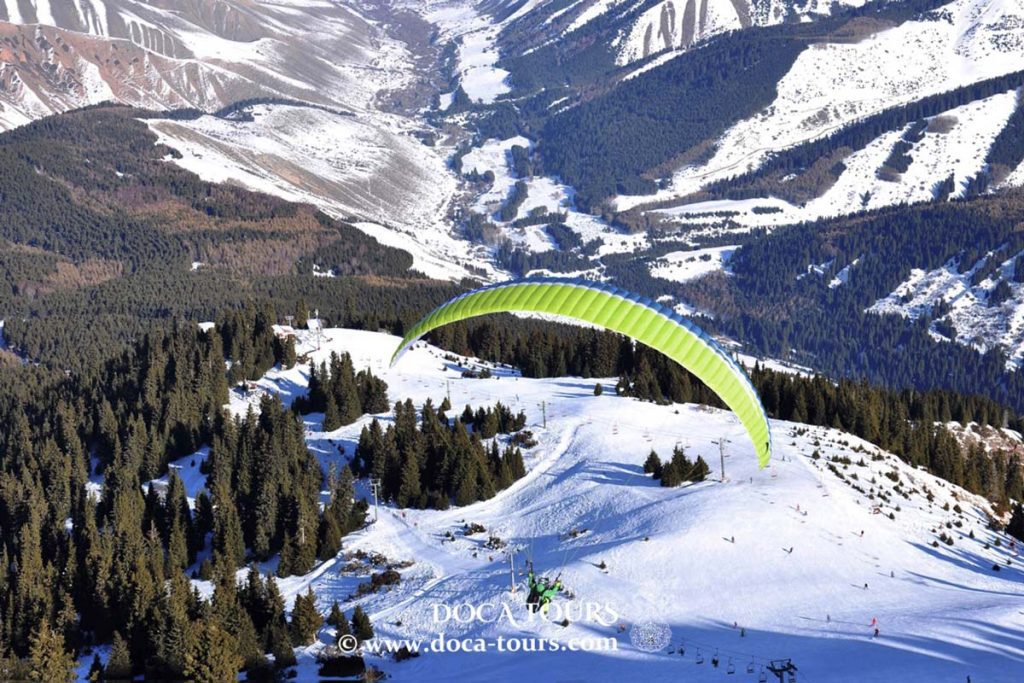
The Karakol Gorge in the Terskey Ala-Too range, 7 km from the city, is home to the Karakol ski base, surrounded by magnificent coniferous forests. The base features five lifts (four of them chairlifts) and operates at altitudes between 2,300 and 3,450 meters. During the Soviet era, it was used as a training ground for the Olympic ski team. From the panoramic summit at 3,040 meters, visitors can enjoy breathtaking views of Issyk-Kul and nearby peaks, including Karakol Peak (5,281 m) and the sharp summit of Jigit Peak (5,173 m).
Climate
Karakol experiences a moderately continental climate with elements of mountain and maritime influences. The average annual precipitation ranges from 350 to 450 mm.
History
After the fall of the Dzungar Khanate to Qing China in 1758, the Kyrgyz of the Issyk-Kul region remained independent and were not incorporated into the Qing Empire. Natural borders emerged south of Lake Issyk-Kul, defined by the high mountain ranges of the Tian Shan.
In the 1820s–1830s, the Kokand Khanate began expanding its influence over Kyrgyz lands through trade and military campaigns. The Kyrgyz of Issyk-Kul were invited to join the khanate voluntarily, but after their refusal, Kokand launched a military expedition in 1831 under Hak-Kul to subdue the Naryn and Issyk-Kul regions. By 1832, the Kokand forces subdued the Bugus (a Kyrgyz tribe in the eastern Issyk-Kul area) and established small fortifications along the shores of Issyk-Kul, including Karakol, Barskoon, and Konur-Uleng. Each of these forts housed Kokand garrisons of 40–60 soldiers, who protected trade caravans and helped collect taxes. Administratively, Karakol and the entire Issyk-Kul region were under the Tashkent governorship of the Kokand Khanate.
In 1843, the Kyrgyz of Issyk-Kul revolted against Kokand. Taking advantage of the assassination of Madali Khan, the Kyrgyz expelled Kokand officials from fortifications along the rivers Karakol, Barskoon, and Konur-Uleng. After this rebellion, the Kyrgyz of these regions became independent and increasingly aligned themselves with the Russian Empire.
The leader of the local Bugu tribe, Borombai, sought closer ties with Russia due to ongoing wars with the Sarybagysh tribe and the Kokand Khanate, as well as threats from the Qing Empire. In 1855, the Bugu formally accepted Russian citizenship.
In 1857, an expedition led by Semenov-Tyan-Shansky arrived at Issyk-Kul with 49 Cossacks and Bugu guides. At that time, the Bugus and Sarybagysh tribes were at war. Before the arrival of the Russian unit, the Sarybagysh had driven the Bugus out of the Issyk-Kul basin over the Santash Pass. However, upon hearing of the well-armed Russian expedition, the Sarybagysh retreated and released their Bugu captives. Semenov crossed the Karakol River at a location where the city of Karakol would later be founded. He noted the area’s sandy riverbanks, overgrown with barberry and sea buckthorn, but did not mention any settlements or remnants of a Kokand fortress. It is likely the fort had been abandoned and destroyed.
In 1863, a permanent Russian military garrison was established at Issyk-Kul. By 1864 (or 1865, according to some sources), the first Russian settlement in the Issyk-Kul region, Ak-Suy military fortification, was built 10 km from what would later become Karakol.
In 1864, a Muslim uprising occurred in Xinjiang. The Kalmyks (Oirats), who had previously lived in the Qing Empire as a military-serving caste, fled to Issyk-Kul after being targeted by raiders following the establishment of the Dungan Khanate. In the autumn of 1865, 2,000 Kalmyk families sought refuge in the Russian Empire, settling near the Karakol River under the protection of the Russian garrison at Ak-Suy. Over time, most of them relocated, and by 1871 only 30 Kalmyk families remained near Karakol. However, with the city’s subsequent development, many Kalmyks returned.
Ak-Suy Fort was located away from caravan routes to Kashgar, leading some settlers from Ak-Suy, referred to by Kaulbars as “native Sarts,” to relocate to the lower reaches of the Karakol River and establish a small settlement. This settlement likely did not coincide with the eventual city’s location, as Kaulbars distinguishes the two areas in his writings.
The city of Karakol was officially founded on July 1, 1869, as a military-administrative center on the caravan route from the Chui Valley to Kashgaria. The location was selected by Staff Captain Baron Kaulbars, who chose a site near the ruins of the former Kokand fortress of Karakol. An 1879 map refers to the site as the "Karakol Fortification."
After the death of the explorer Nikolay Przhevalsky in Karakol from typhoid fever during his fifth expedition, Tsar Alexander III issued a decree on March 23, 1889, renaming the city to Przhevalsk to honor his memory. Przhevalsky, fulfilling his wish, was buried on the shore of Issyk-Kul.
Economy
Karakol is the primary industrial center of the Issyk-Kul Region. Key industries include:
Machine building: AO Issykkulelektro.
Food and processing industries: AO Karakol-Buudai (grain processing), AO Ak-Bulak (dairy processing), AO Seiyl (non-alcoholic beverage production), and AO Toshtuk (meat production and processing).
Construction materials: AO Temir-Beton.
Light industry: Ayko-Seiko LLC.
The Kyrgyz government has established the Karakol Free Economic Zone (FEZ) to encourage business development and investment.
Nearby, in the village of Koisary (Pokrovka), lies the 954th Russian Navy testing facility, used for torpedo and mine weapon trials.
Education
Karakol is home to several educational institutions, including:
- Issyk-Kul State University named after Kasym Tynystanov.
- Alishpaev Institute of Cooperation.
- Karakol branch of the Moscow Institute of Entrepreneurship and Law.
- Issyk-Kul Center of the Kyrgyz State Law Academy.
- Medical College, Pedagogical College, Music College, and Cooperative Technical School.
- 15 secondary schools, 2 gymnasiums, and 2 lyceums.
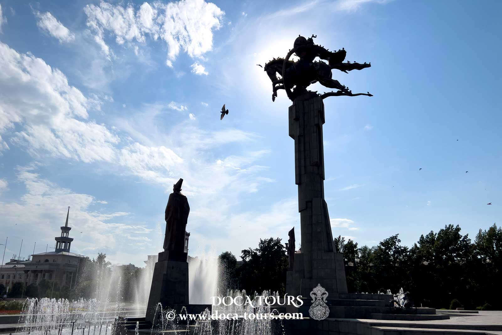
Landmarks
Holy Trinity Orthodox Cathedral: Built in 1895 on the foundation of an earlier church destroyed in the 1889 earthquake. During the Soviet era, it served as a children’s sports school but was returned to the Orthodox community in 1995.
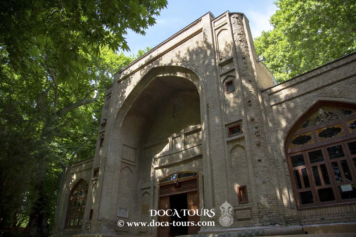
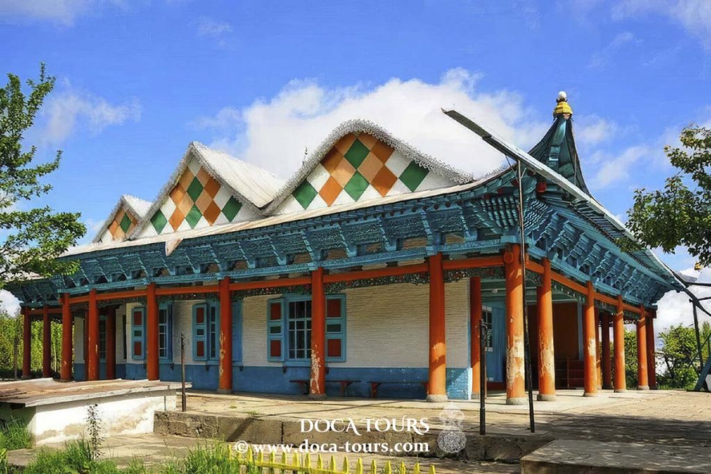
Dungan Mosque: Designed in the style of a Buddhist pagoda (1910). Initiated by Ibrahim Aji, a Dungan community leader, it was constructed by Beijing architect Zhou Syu and 20 Chinese craftsmen skilled in traditional techniques. Built without nails, the mosque features 42 wooden columns and ornate cornices decorated with carvings of plants like grapes, pomegranates, pears, and peaches. During Soviet times (1929–1947), the mosque was used as a warehouse. It was returned to the Muslim community in 1947 and has since operated as a mosque.
City Historical Museum: Showcases the natural history, culture, and ethnology of the Issyk-Kul region, dating back to the Bronze Age. The building was originally the summer house of merchant Ilyin before the revolution.
Bugu-Ene Zoo: Founded in 1987, it is the only zoo in Kyrgyzstan.
Other facilities include a hippodrome (established in 1959) and a livestock yard.
Surroundings of Karakol
Nikolay Przhevalsky Memorial Museum: Located 10 km from Karakol in Pristan-Przhevalsk, it was opened on April 29, 1957, to commemorate the explorer.
Altyn-Arashan Hot Springs: Situated in the Arashan Gorge, 10 km from Karakol near the village of Ak-Suu, these natural hot springs are a popular tourist attraction.
Karakol Ski Resort: About 30 minutes from Karakol, the resort features five ski lifts (see the Geography section above for details).
Barskoon Valley: A protected area since 1975, located in the Jeti-Oguz District, 90 km southwest of Karakol. The valley is known for two waterfalls, one at the mountain's summit and another along its slopes.
Skazka Canyon: Known as “Fairy Tale Canyon” for its unique rock formations sculpted by wind over millennia, creating fascinating natural sculptures.
Dead Lake: Open to tourists since 2001, this salty lake is often compared to the Dead Sea and is featured in tourism materials as “Kyrgyzstan’s Dead Lake.”
Chon-Koysu Archaeological Site: Ruins of a settlement dating back to the 14th and 15th centuries have been studied near Karakol.
Recreational Activities: Kayaking tours are available in Przhevalsky Bay.
Sister Cities
Asheville, North Carolina, United States
Gebze, Kocaeli, Turkey

 The city covers an area of 52.53 km² and had a population of 81,952 as of early 2023, according to estimates by the National Statistical Committee of the Kyrgyz Republic (including the settlement of Pristan-Przhevalsk). To the north, along the EM-09 highway, is the town of Tyup, while the Jeti-Oguz resort lies to the southwest.
Located in the eastern part of Issyk-Kul Region, Karakol sits at the foot of the Terskey Ala-Too mountain range in the lower reaches of the Karakol River. It is 12 km from the shore of Lake Issyk-Kul, 400 km from Bishkek, and 220 km by road (or 184 km by water) from the nearest railway station in Balykchy.
The city covers an area of 52.53 km² and had a population of 81,952 as of early 2023, according to estimates by the National Statistical Committee of the Kyrgyz Republic (including the settlement of Pristan-Przhevalsk). To the north, along the EM-09 highway, is the town of Tyup, while the Jeti-Oguz resort lies to the southwest.
Located in the eastern part of Issyk-Kul Region, Karakol sits at the foot of the Terskey Ala-Too mountain range in the lower reaches of the Karakol River. It is 12 km from the shore of Lake Issyk-Kul, 400 km from Bishkek, and 220 km by road (or 184 km by water) from the nearest railway station in Balykchy.
 In 1843, the Kyrgyz of Issyk-Kul revolted against Kokand. Taking advantage of the assassination of Madali Khan, the Kyrgyz expelled Kokand officials from fortifications along the rivers Karakol, Barskoon, and Konur-Uleng. After this rebellion, the Kyrgyz of these regions became independent and increasingly aligned themselves with the Russian Empire.
The leader of the local Bugu tribe, Borombai, sought closer ties with Russia due to ongoing wars with the Sarybagysh tribe and the Kokand Khanate, as well as threats from the Qing Empire. In 1855, the Bugu formally accepted Russian citizenship.
In 1857, an expedition led by Semenov-Tyan-Shansky arrived at Issyk-Kul with 49 Cossacks and Bugu guides. At that time, the Bugus and Sarybagysh tribes were at war. Before the arrival of the Russian unit, the Sarybagysh had driven the Bugus out of the Issyk-Kul basin over the Santash Pass. However, upon hearing of the well-armed Russian expedition, the Sarybagysh retreated and released their Bugu captives. Semenov crossed the Karakol River at a location where the city of Karakol would later be founded. He noted the area’s sandy riverbanks, overgrown with barberry and sea buckthorn, but did not mention any settlements or remnants of a Kokand fortress. It is likely the fort had been abandoned and destroyed.
In 1843, the Kyrgyz of Issyk-Kul revolted against Kokand. Taking advantage of the assassination of Madali Khan, the Kyrgyz expelled Kokand officials from fortifications along the rivers Karakol, Barskoon, and Konur-Uleng. After this rebellion, the Kyrgyz of these regions became independent and increasingly aligned themselves with the Russian Empire.
The leader of the local Bugu tribe, Borombai, sought closer ties with Russia due to ongoing wars with the Sarybagysh tribe and the Kokand Khanate, as well as threats from the Qing Empire. In 1855, the Bugu formally accepted Russian citizenship.
In 1857, an expedition led by Semenov-Tyan-Shansky arrived at Issyk-Kul with 49 Cossacks and Bugu guides. At that time, the Bugus and Sarybagysh tribes were at war. Before the arrival of the Russian unit, the Sarybagysh had driven the Bugus out of the Issyk-Kul basin over the Santash Pass. However, upon hearing of the well-armed Russian expedition, the Sarybagysh retreated and released their Bugu captives. Semenov crossed the Karakol River at a location where the city of Karakol would later be founded. He noted the area’s sandy riverbanks, overgrown with barberry and sea buckthorn, but did not mention any settlements or remnants of a Kokand fortress. It is likely the fort had been abandoned and destroyed.
 In 1863, a permanent Russian military garrison was established at Issyk-Kul. By 1864 (or 1865, according to some sources), the first Russian settlement in the Issyk-Kul region, Ak-Suy military fortification, was built 10 km from what would later become Karakol.
In 1864, a Muslim uprising occurred in Xinjiang. The Kalmyks (Oirats), who had previously lived in the Qing Empire as a military-serving caste, fled to Issyk-Kul after being targeted by raiders following the establishment of the Dungan Khanate. In the autumn of 1865, 2,000 Kalmyk families sought refuge in the Russian Empire, settling near the Karakol River under the protection of the Russian garrison at Ak-Suy. Over time, most of them relocated, and by 1871 only 30 Kalmyk families remained near Karakol. However, with the city’s subsequent development, many Kalmyks returned.
Ak-Suy Fort was located away from caravan routes to Kashgar, leading some settlers from Ak-Suy, referred to by Kaulbars as “native Sarts,” to relocate to the lower reaches of the Karakol River and establish a small settlement. This settlement likely did not coincide with the eventual city’s location, as Kaulbars distinguishes the two areas in his writings.
In 1863, a permanent Russian military garrison was established at Issyk-Kul. By 1864 (or 1865, according to some sources), the first Russian settlement in the Issyk-Kul region, Ak-Suy military fortification, was built 10 km from what would later become Karakol.
In 1864, a Muslim uprising occurred in Xinjiang. The Kalmyks (Oirats), who had previously lived in the Qing Empire as a military-serving caste, fled to Issyk-Kul after being targeted by raiders following the establishment of the Dungan Khanate. In the autumn of 1865, 2,000 Kalmyk families sought refuge in the Russian Empire, settling near the Karakol River under the protection of the Russian garrison at Ak-Suy. Over time, most of them relocated, and by 1871 only 30 Kalmyk families remained near Karakol. However, with the city’s subsequent development, many Kalmyks returned.
Ak-Suy Fort was located away from caravan routes to Kashgar, leading some settlers from Ak-Suy, referred to by Kaulbars as “native Sarts,” to relocate to the lower reaches of the Karakol River and establish a small settlement. This settlement likely did not coincide with the eventual city’s location, as Kaulbars distinguishes the two areas in his writings.
 The city of Karakol was officially founded on July 1, 1869, as a military-administrative center on the caravan route from the Chui Valley to Kashgaria. The location was selected by Staff Captain Baron Kaulbars, who chose a site near the ruins of the former Kokand fortress of Karakol. An 1879 map refers to the site as the "Karakol Fortification."
After the death of the explorer Nikolay Przhevalsky in Karakol from typhoid fever during his fifth expedition, Tsar Alexander III issued a decree on March 23, 1889, renaming the city to Przhevalsk to honor his memory. Przhevalsky, fulfilling his wish, was buried on the shore of Issyk-Kul.
The city of Karakol was officially founded on July 1, 1869, as a military-administrative center on the caravan route from the Chui Valley to Kashgaria. The location was selected by Staff Captain Baron Kaulbars, who chose a site near the ruins of the former Kokand fortress of Karakol. An 1879 map refers to the site as the "Karakol Fortification."
After the death of the explorer Nikolay Przhevalsky in Karakol from typhoid fever during his fifth expedition, Tsar Alexander III issued a decree on March 23, 1889, renaming the city to Przhevalsk to honor his memory. Przhevalsky, fulfilling his wish, was buried on the shore of Issyk-Kul.
 City Historical Museum: Showcases the natural history, culture, and ethnology of the Issyk-Kul region, dating back to the Bronze Age. The building was originally the summer house of merchant Ilyin before the revolution.
Bugu-Ene Zoo: Founded in 1987, it is the only zoo in Kyrgyzstan.
Other facilities include a hippodrome (established in 1959) and a livestock yard.
City Historical Museum: Showcases the natural history, culture, and ethnology of the Issyk-Kul region, dating back to the Bronze Age. The building was originally the summer house of merchant Ilyin before the revolution.
Bugu-Ene Zoo: Founded in 1987, it is the only zoo in Kyrgyzstan.
Other facilities include a hippodrome (established in 1959) and a livestock yard.