ASHGABAT
- Geographical coordinates: 37°57′ N. lat. 58°23′ E
- Former names: Askhabad, Poltoratsk, Ashgabat
- Elevation: 273 m
- Official language: Turkmen
- Popular languages: Russian, Uzbek etc.
- Nationality: Turkmen, Uzbeks, Russians, Armenians, etc.
- Population: 1,030,063 (2022)
- Time Zone: UTC+5
- Telephone Code: +993 12
- Postal Codes: 744000–744901
- Vehicle Registration Code: AG
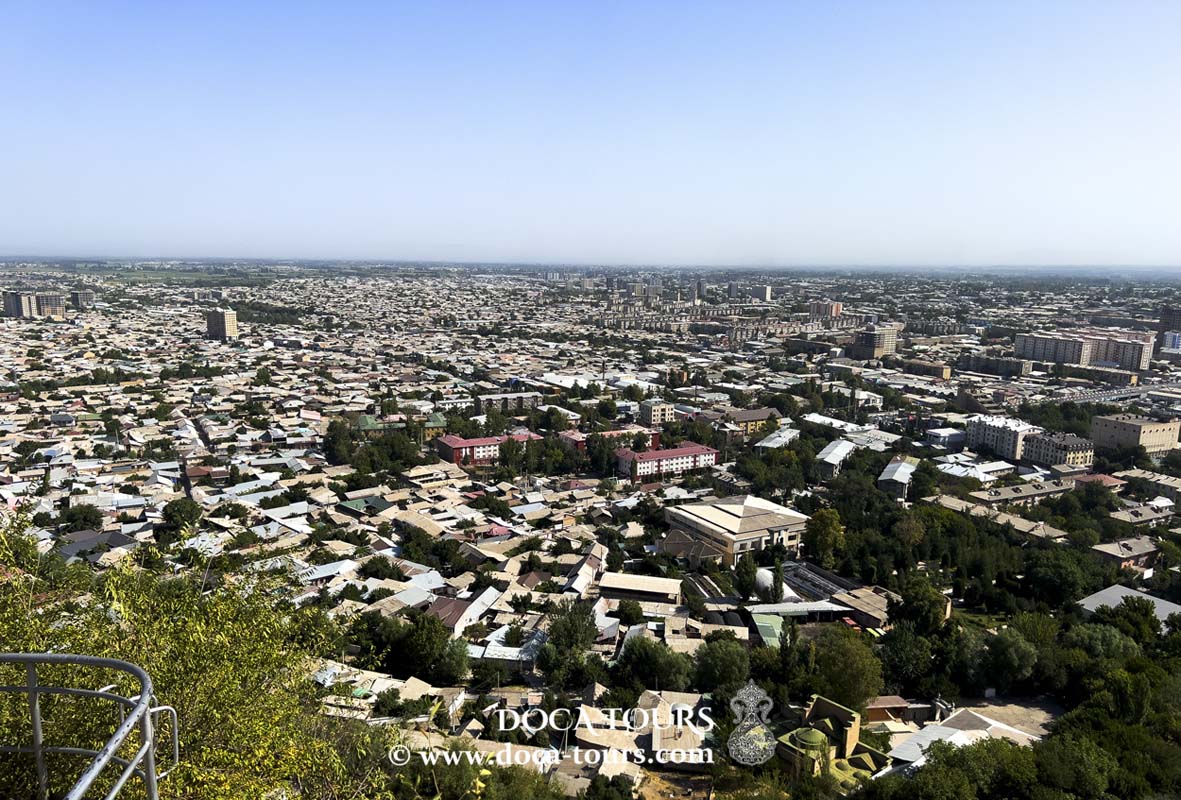
Ashgabat, also known as Aşgabat (Turkmen: Aşgabat), is the capital and largest city of Turkmenistan, serving as the country's primary administrative, political, industrial, scientific, and cultural hub. It holds the status of a separate administrative-territorial entity within Turkmenistan, functioning as a city with the rights of a velayat (province).
The history of Ashgabat dates back to the Parthian city of Konjikala (2nd century BCE – 13th century CE), which was a key point along the Great Silk Road during the Middle Ages. In the mid-19th century, Ashgabat was a trading center interacting with neighboring states. The city entered a new phase of development in 1881.
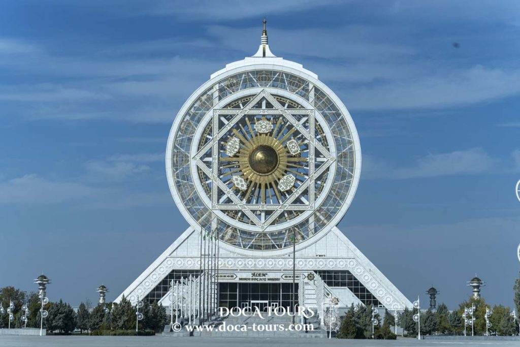
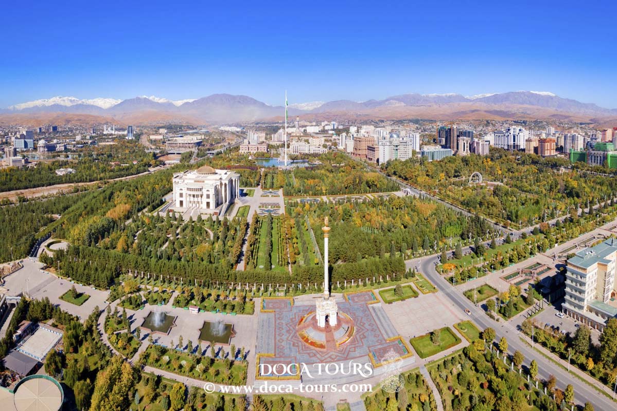
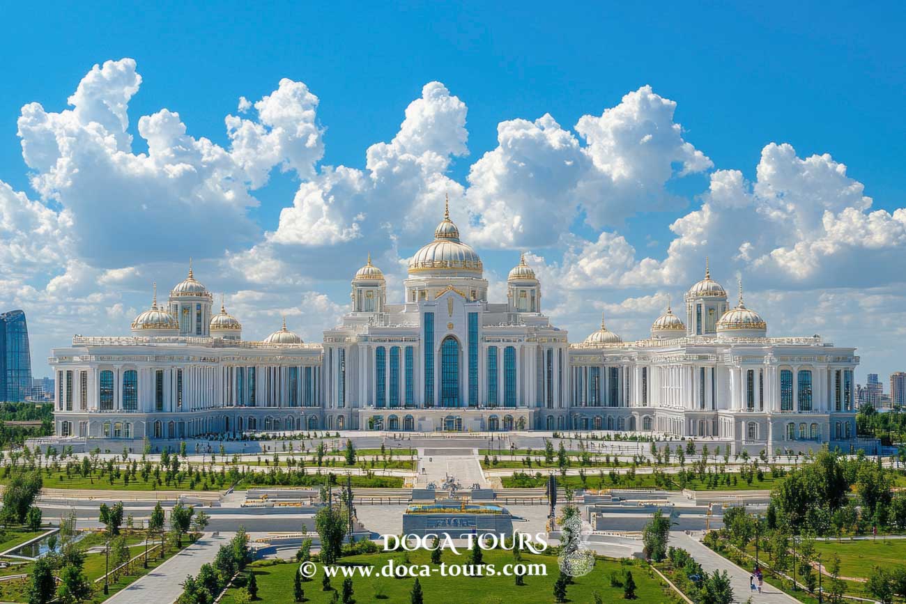
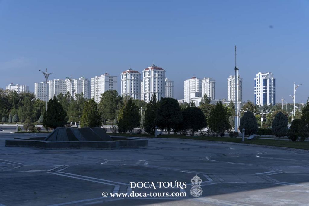
On May 25, 2013, Ashgabat was included for the fifth time in the Guinness World Records as the city with the most white marble buildings in the world (543 newly constructed white marble-clad structures). Previously, other landmarks of the Turkmen capital had also earned recognition in the record book, such as the world’s fourth-tallest flagpole (133 meters), the largest fountain complex (27 synchronized fountains), the largest enclosed Ferris wheel, and the largest architectural depiction of a star — the eight-pointed star of Oguz Khan on the city’s TV tower.

According to official data from the State Committee of Turkmenistan on Statistics, as of January 1, 2012, Ashgabat was home to 12.7% of the country’s population. The 1995 census recorded a population of 604,700, which grew to an estimated 712,000 in 2001. By July 1, 2002, the population was officially estimated at 743,000, reaching 790,000 in mid-2003 (13% of the national population). On November 18, 2005, it was announced that the city's population had surpassed 900,000 (13.4% of the total population). On August 6, 2018, it was officially reported that Ashgabat’s population exceeded 1 million residents.
Etymology
The city's name is derived from the Persian words eshq (meaning "love") and ābād (meaning "settlement" or "city").
After the Russian Empire's conquest of Turkestan, the city officially became part of Russia under the Akhal Treaty with Persia on September 21, 1881, and was named "Askhabad." This name remained in use until 1919.
On July 17, 1919, the city was renamed "Poltoratsk" in honor of the revolutionary figure and chairman of the Turkestan Republic's Supreme Council of National Economy, P.G. Poltoratsky (1888–1918).
On October 27, 1927, the city received the name "Ashkhabad."
After Turkmenistan declared its independence on October 27, 1991, several settlements in the country were renamed. As part of this process, the city of Ashkhabad was officially renamed "Ashgabat" on April 17, 1992, by a decree of the Presidium of the Supreme Council of Turkmenistan (No. 686-XII), reflecting the original Turkmen pronunciation.
In Russia, the name "Ashkhabad" continues to be used officially, as confirmed by the Russian Presidential Administration's directive No. 1495, dated August 17, 1995, which specifies the spelling of the names of former Soviet republics and their capitals.
Currently, in Turkmenistan's legislative documents (including Russian-language texts), official media, and on the capital's official websites, the city is referred to as "Ashkhabad."
Some Turkmen historians have suggested that the city's name is linked to the Arsacid (Ashkanid) dynasty of Parthian kings, with the city's origins traced back to the 3rd century BCE. However, historical evidence indicates that the city itself was founded in the 19th century as a fortress, while Nisa, located 18 km away and founded in the 3rd century BCE, served as one of the capitals of the Parthian Empire.
Geography
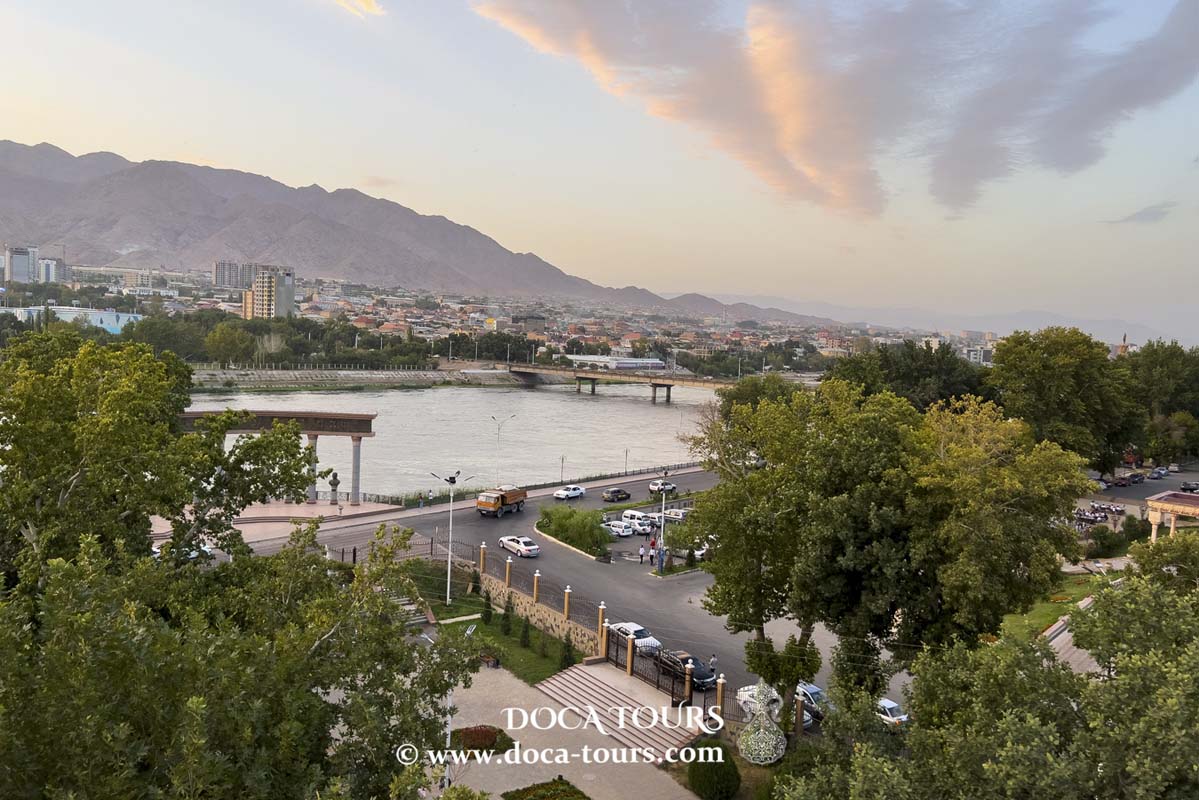
Ashgabat is located in southern Turkmenistan, about 25 kilometers north of the Iranian border, on the Turan Lowland.
The city lies within the Akhal-Teke oasis, situated on the foothill plains of the Kopetdag Mountains, which border it to the south, while the Karakum Desert stretches to the north. Ashgabat is 214–240 meters above sea level.
In 1962, the Karakum Canal was extended to the city, addressing water supply issues.
Time Zone
Ashgabat operates in the time zone designated as UTC+5, with a five-hour offset from Coordinated Universal Time (UTC).
Climate
The climate of Ashgabat is classified as subtropical continental, characterized by mild winters that are unusually cold for the region and hot summers. In some years, temperatures can exceed +45°C. Most of the annual precipitation, totaling 221 mm, falls in winter and spring, while summer is typically dry.
Winters are brief, but cold spells from the north can bring temperatures below −10 to −15°C. On average, the city experiences eight days of snow cover annually, with a 10% chance of snowless winters. The maximum recorded snow depth is 34 cm.
For most of the year, including spring, Ashgabat remains hot. For instance, on March 16, 2010, the temperature spiked to +38.6°C, setting a new March record. In some southern regions of the country, the temperature reached +39.3°C on the same day. By late summer, the extreme heat slightly decreases compared to June. Theoretically, Ashgabat's temperature can exceed +40°C in March, +44°C in April, and +48°C in August.
The average annual temperature is +17.5°C.
The average wind speed is 2.5 m/s, and the annual relative humidity averages 55%.
History
Ashgabat was established on the ruins of Konjikala, a city along the Great Silk Road, first mentioned in the 2nd century BCE. In the 1st century BCE, an earthquake destroyed Konjikala. The city was later rebuilt due to its advantageous location but was eventually razed by the Mongols in the 13th century.
The nearby suburb of Köşi, formerly a separate village until it became part of Ashgabat in 2013, once housed a Parthian fortress built to defend the capital of Nisa. This conclusion was drawn by archaeologists in the 1970s and further supported by artifacts discovered during excavations in 2020. Additional evidence of Parthian-era settlements was found during the installation of telephone cables near the Guliustan shopping center in the city center. In total, at least 40 ancient ruins, including remains of settlements, fortresses, and estates from the Parthian period, have been identified in the Ashgabat area.
According to I.I. Stebnitsky in his 1871 book Notes on Turkmenia, Ashgabat was a trading hub with Khiva and Persia, and its population, including surrounding areas, was about 16,000 at the time.
The city's growth accelerated in 1881 when it became the administrative center of the Transcaspian region of the Russian Empire, governed by military authorities. At that time, Ashgabat consisted primarily of clay houses surrounded by orchards. The streets were designed to be straight, with mostly single-story buildings, as a precaution against earthquakes.
In 1881, a post office was established, later upgraded to a post and telegraph office in 1889. By 1917, Ashgabat had three postal branches. In 1888, the city had become a district center with many stone buildings and wide streets. It featured numerous well-stocked shops, restaurants, and gardens. The railway station, built according to the design of academician Urlaub, was another prominent landmark.
By 1901, the population of Ashgabat was 36,500, including 11,200 Persians, 10,700 Russians, and 14,600 Armenians and others. Turkmen tribes primarily lived outside the city in nomadic settlements.
From 1881 to 1918, Ashgabat served as the administrative center of the Transcaspian region of the Russian Empire. From 1918 to 1925, it was the administrative center of the Turkestan ASSR’s Turkmen region.
In February 1925, Ashgabat (then called Poltoratsk in honor of Bolshevik Pavel Poltoratsky) became the capital of the Turkmen SSR. On February 4, 1927, the city was renamed Ashgabat, and surrounding villages were also renamed accordingly.
On October 6, 1948, Ashgabat was struck by one of the most devastating earthquakes in history. Its magnitude was 7.3, and the intensity at the epicenter reached 9–10 on the Mercalli scale. Between 90% and 98% of the city's buildings were destroyed. Casualty estimates range from 60,000 to 110,000 people, with official Turkmen sources stating 176,000 lives were lost.
In 1962, the Karakum Canal reached Ashgabat, resolving chronic water shortages.
In July 2003, Ashgabat’s street names were replaced with numerical designations, except for nine major avenues, some of which were named after Saparmurat Turkmenbashi, his parents, and the revered poet Magtymguly. The central Palace Square was numbered 2000, symbolizing the beginning of the "Golden Age" of the Turkmen people.
From September 10 to 14, 2008, an armed uprising occurred in the city, known as the "Ashgabat Rebellion." Heavy armored vehicles were deployed to suppress militants in the Khitrovka district. Witnesses reported explosions and gunfire in the city’s northern areas over the weekend. Official reports claimed the militants were involved in drug trafficking, but some independent sources suggested they were radical opposition members. Turkmen President Gurbanguly Berdimuhamedow confirmed that intelligence officers had died in the clashes.
Population
According to the State Committee of Turkmenistan on Statistics, as of January 1, 2012, Ashgabat was home to 12.7% of the country’s population. However, no official data on Turkmenistan’s total population has been published, and a census conducted from December 15 to 26, 2012, remained unpublished as of January 2018, despite preliminary results being expected by mid-2013. A new national census was scheduled for December 17–27, 2022.
The 1995 census recorded Ashgabat’s population at 604,700. By 2001, official estimates placed the population at 712,000. On July 1, 2002, it had risen to 743,000, and by mid-2003, it was estimated at 790,000 (13% of the national total). On November 18, 2005, the city’s population was officially reported to have reached 900,000 (13.4% of the country’s population).
The CIA World Factbook estimated Turkmenistan's population at 5.17 million as of May 2014, suggesting that Ashgabat's population might be around 650,000. During the December 2013 elections for the Majlis (Parliament), voter statistics showed 396,000 registered voters in Ashgabat out of 3,063,000 nationwide, meaning 12.9% of the country's voters were based in the capital. According to the U.S. Census Bureau, approximately 33% of Turkmenistan's population was under 18 in 2013, implying a national population of 4.57 million, with Ashgabat housing roughly 590,000 residents. This figure, however, exceeded the official voter data, as the Bureau estimated 3.45 million citizens aged 18 or older, which was 12.6% higher than the published number of voters.
In the March 2018 Majlis elections, 3,291,312 voters were registered nationwide, including 454,448 in Ashgabat (13.8% of the total). These figures suggested a national population of around 4.9 million and a city population of approximately 680,000 in spring 2018. The CIA estimated Ashgabat's population at 810,000 that same year. By August 2018, official reports indicated Ashgabat's population had reached 1 million. Comparing the city's total population (1 million) with the number of adult residents (454,000 voters) implies 546,000 minors, though this conflicts with the 2017/2018 academic year data, which recorded only 146,500 secondary school students.
As of 2006, ethnic Turkmen made up 77% of Ashgabat’s population. The remaining 23% comprised Russians, Armenians, Uzbeks, Ukrainians, Azerbaijanis, Turks, Tatars, Persians, Kazakhs, and representatives of over 100 other ethnic groups.
In 1991, restrictions were introduced, prohibiting non-residents from registering in Ashgabat. This ban was lifted in autumn 2012.
Economy
Ashgabat's economy is primarily driven by industry, financial institutions, and a broad retail network. In 2008, the city’s estimated gross domestic product (GDP) amounted to approximately $9 billion.
Located five kilometers north of Ashgabat is the renowned Altyn Asyr Oriental Bazaar.
Shopping Centers
Berkarar Shopping and Entertainment Center: The largest mall in Turkmenistan, with four floors and over 340 retail outlets.
Ashgabat Shopping Center.
15 Years of Independence Shopping Center.
Major Bazaars
- Altyn Asyr Oriental Bazaar.
- Gulistan State Trading Center (Russian Bazaar).
- Tekinsky Bazaar.
- Dashoguz (Azatlyk) Bazaar (10th microdistrict).
- Lalezar Bazaar (6th microdistrict).
- Parahat Bazaar (Mir-1 microdistrict).
- Jennet Bazaar (3rd microdistrict).
- Ak Yol Bazaar (8th microdistrict).
Wholesale and Retail Trade
The Bedev store chain specializes in the sale of construction materials, plumbing supplies, and automotive spare parts.
Industry
Ashgabat and its suburbs host more than 43 large industrial facilities, 128 medium-sized enterprises, and over 1,700 small industrial establishments. Key industrial companies include Ashneftemash, Turkmenkabel, and Turkmenbashi Textile Complex, among others.
Communication
Ashgabat has 38 postal service branches operated by Turkmenpost and a DHL Express office.
The city has one wired telephone service provider, the Ashgabat City Telephone Network. As of 2021, there were over 235,000 cable telephone subscribers.
Two internet service providers, AGTS and Turkmentelecom, offer internet access in Ashgabat. The most common internet connection types include Ethernet, GPON, and ADSL. Previously popular Dial-up connections have largely been replaced by wireless technologies like Wi-Fi.
Ashgabat features nine internet cafes, and public areas are equipped with Wi-Fi networks offering unlimited internet access.
Mobile Communication
Ashgabat has two mobile network operators:
Altyn Asyr – a state-owned national telecommunications company established in 2004. In 2010, it launched a third-generation (3G) UMTS network, covering all districts of Ashgabat and the city’s international airport. On September 18, 2013, the company introduced its fourth-generation (4G) LTE network.
Ashgabat City Telephone Network – provides CDMA services with over 55,000 subscribers. This network was the first of its kind in the city, launched in 2003.
Transportation
Historical Development
By 1899, Ashgabat had 45 paved streets spanning a total length of 13,714 fathoms. The city used 136 carriages to transport people, and by 1912, there were 216 personal horse-drawn cabs.
The first automobiles appeared in Ashgabat in the early 20th century. In 1910, a car route was established between Ashgabat and Firyuza, with travel time lasting two hours.
On June 10, 1920, unified traffic regulations were adopted.
Modern Public Transport
Currently, public transport in Ashgabat consists exclusively of buses. From October 19, 1964, to December 31, 2011, the city also operated a trolleybus system. In the early 20th century, a narrow-gauge steam-powered railway connected Ashgabat to Firyuza, located 39 km northeast of the city. Today, the city’s bus fleet primarily includes new Mercedes-Benz and Hyundai models. Additionally, a cable car system connects Ashgabat to the foothills of the Kopetdag Mountains in the city’s southern part.
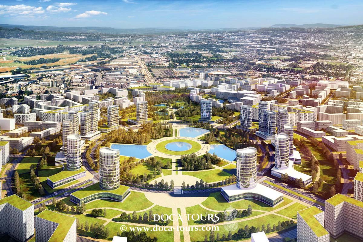
In 2008, construction began on a ring road around Ashgabat to ease traffic congestion and provide a convenient route for transit vehicles. Between 2010 and 2011, major avenues like Saparmurat Turkmenbashi Avenue, Garashsyzlyk, Gurbansoltan Eje, Bitarap Turkmenistan, and Magtymguly, as well as streets like Atamurat Niyazov, Ataturk, Andalib, and Oguz Khan, were renovated. The modern Chandibil Avenue, running parallel to Archabil Highway, was also constructed.
Ashgabat Metro
Plans to build a metro system in Ashgabat were announced in 2008. In 2014, President Gurbanguly Berdimuhamedow instructed the head of the Ukrainian construction association Interbudmontazh to evaluate the feasibility of constructing a metro, given the city's growing population.
Ashgabat Monorail
In 2016, a monorail system over 5,138 meters long was inaugurated in the Olympic Village. The system includes eight stations and operates with three-car trains.
Railway and Intercity Bus Transport
The modern Ashgabat railway station, originally built in 1888, is located on Gurbansoltan Eje Avenue, near the city center. Although destroyed in the 1948 earthquake, it was rebuilt in 1950 on the foundation of the original station and underwent a major renovation in 2009. The city lies on the Turkmenbashi–Mary–Turkmenabat railway, which runs west to east. Additionally, a new line, the Trans-Karakum Railway (Ashgabat–Karakum–Dashoguz), opened in February 2006.
The city has a bus terminal near the Tekinsky Bazaar. A new international bus terminal was opened in northern Ashgabat in September 2014.
Air Transport
The Saparmurat Turkmenbashi International Airport, operational since 1994, is located 10 km northwest of Ashgabat’s center. During the Soviet era, it functioned as a domestic airport. A new passenger terminal was completed in 1994, and in January 2013, construction began on a $2.2 billion new airport. A temporary terminal with a capacity of 1,250 passengers per hour was opened in March 2014 during the construction of the main terminal. This terminal, built on the site of the former Soviet-era airport on Boulevard Kosmonavtov, now handles charter flights. The airport connects Ashgabat with major cities in Turkmenistan, CIS countries, Asia, and Europe.
Cyclists and Pedestrians
The city’s infrastructure is highly pedestrian-friendly, with numerous walking paths. Although cycling infrastructure is still developing, bike paths are gradually being introduced.
Education
Ashgabat is a major educational hub in Turkmenistan, hosting numerous academic institutions. As of the 2013/2014 academic year, 26,700 students were enrolled in 19 universities, while 114,700 students attended 139 schools across the city.
Key higher education institutions include:
- Turkmen State University named after Magtymguly
- International Turkmen-Turkish University
- Turkmen State Medical University
- Turkmen Agricultural University named after S.A. Niyazov
- International University of Oil and Gas named after Yagshygeldi Kakaev
- State Academy of Arts of Turkmenistan
- Turkmen Institute of National Economy
- Turkmen State Institute of Culture
- Turkmen State Institute of Engineering and Transportation Communications
- National Institute of Physical Education and Sports of Turkmenistan
- Turkmen National Institute of World Languages named after Dovletmammed Azadi
- Institute of International Relations of the Ministry of Foreign Affairs of Turkmenistan
- Turkmen State Institute of Economics and Management
- Turkmen State Financial Institute
- Turkmen National Conservatory
- Military Academy of Turkmenistan named after Saparmurat Turkmenbashi
- Military Institute named after Saparmurat Turkmenbashi of the Ministry of Defense of Turkmenistan
- Police Academy of Turkmenistan named after General of the Army S.A. Niyazov
- Institute for Border Guards of the State Border Service of Turkmenistan
- Turkmen State Institute of Architecture and Construction
- International University for the Humanities and Development
- Institute of Telecommunications and Informatics of Turkmenistan
Science
The Turkmen Academy of Sciences was founded in Ashgabat in 1951. In 2014, a state-of-the-art Technology Center of the Academy was inaugurated in the Bikrova district. The city is also home to a Botanical Garden.
Sports
Equestrian Sports
Both amateur and professional sports are well-developed in Ashgabat. The city boasts five stadiums with seating for over 1,000 spectators, sports halls, ice arenas, swimming pools, and other facilities. Notable venues include:
- Olympic Stadium
- Ashgabat Stadium
- National Olympic Ice Palace
- Winter Sports Complex
- Olympic Water Sports Complex
- Kopetdag Stadium
On December 19, 2010, Ashgabat was selected in Kuwait to host the 5th Asian Indoor and Martial Arts Games, becoming the first city in Central Asia to receive this honor. Since 2010, an Olympic Village has been under construction in the southern part of Ashgabat, comprising over 30 facilities, including a Paralympic complex and rehabilitation center.
Professional Sports Clubs
Football: Altyn Asyr FC, Ashgabat FC, MTTU FC, and SK Hazyna compete in the Turkmenistan Championship. Kopetdag FC, a renowned club established in 1947, currently plays in the First League of Turkmenistan.
Ice Hockey: Burgut HC is among the country’s top hockey teams. Other notable clubs based in Ashgabat include Alp Arslan HC, youth teams Bagtyyarlyk HC, Galkan HC, Shir HC, and Oguzhan HC.
Ashgabat is also home to Turkmenistan's largest International Equestrian Complex, situated in the Ruhabat district on Kopetdag Avenue near the National Museum of Wildlife. Spanning 90 hectares, the complex hosts horse racing and trotting events.
Healthcare
Turkmenistan has established a modern, fee-based national healthcare system. As of 2013, the country had 490 family doctors, 3,800 mid-level medical staff, and 3,600 hospital beds. Major medical facilities in Ashgabat include:
International Trauma Center: Built in 2011, it is the largest trauma center in the country.
Oncology Center: A clinical facility for diagnosing and treating benign and malignant tumors, established in 2009.
Saparmurat Turkmenbashi Central Hospital: Opened in 2001 in Bikrova, with a capacity of 120 patients.
Dental Center
Pharmaceutical Plant: Specializing in the production of infusion solutions.
- International Medical Centers Directorate
- Ashgabat features a state-of-the-art medical complex called the Directorate of International Medical Centers. It includes:
- International Eye Treatment Center: One of Central Asia's largest eye care facilities, located in the southern part of the city.
- International Medical Center
- International Center for Internal Diseases
- International Diagnostic Center
- Mother and Child Health Center "Ene Myahri"
- International Center for Head and Neck Diseases
- Infectious Disease Centers Administration
On September 1, 2010, six new clinics were opened in Ashgabat’s northern district under the Ministry of Health and Medical Industry.
These include:
- Central Dermatology and Venereology Hospital
- Tuberculosis Treatment and Prevention Center
- Infectious Disease Treatment and Prevention Center
- AIDS Prevention Center
- Centralized Laboratory
- Blood Center
- Tourism
Ashgabat boasts a recreational area near its "Golden Lake," offering various leisure facilities.
Landmarks
Cultural and Entertainment Venues
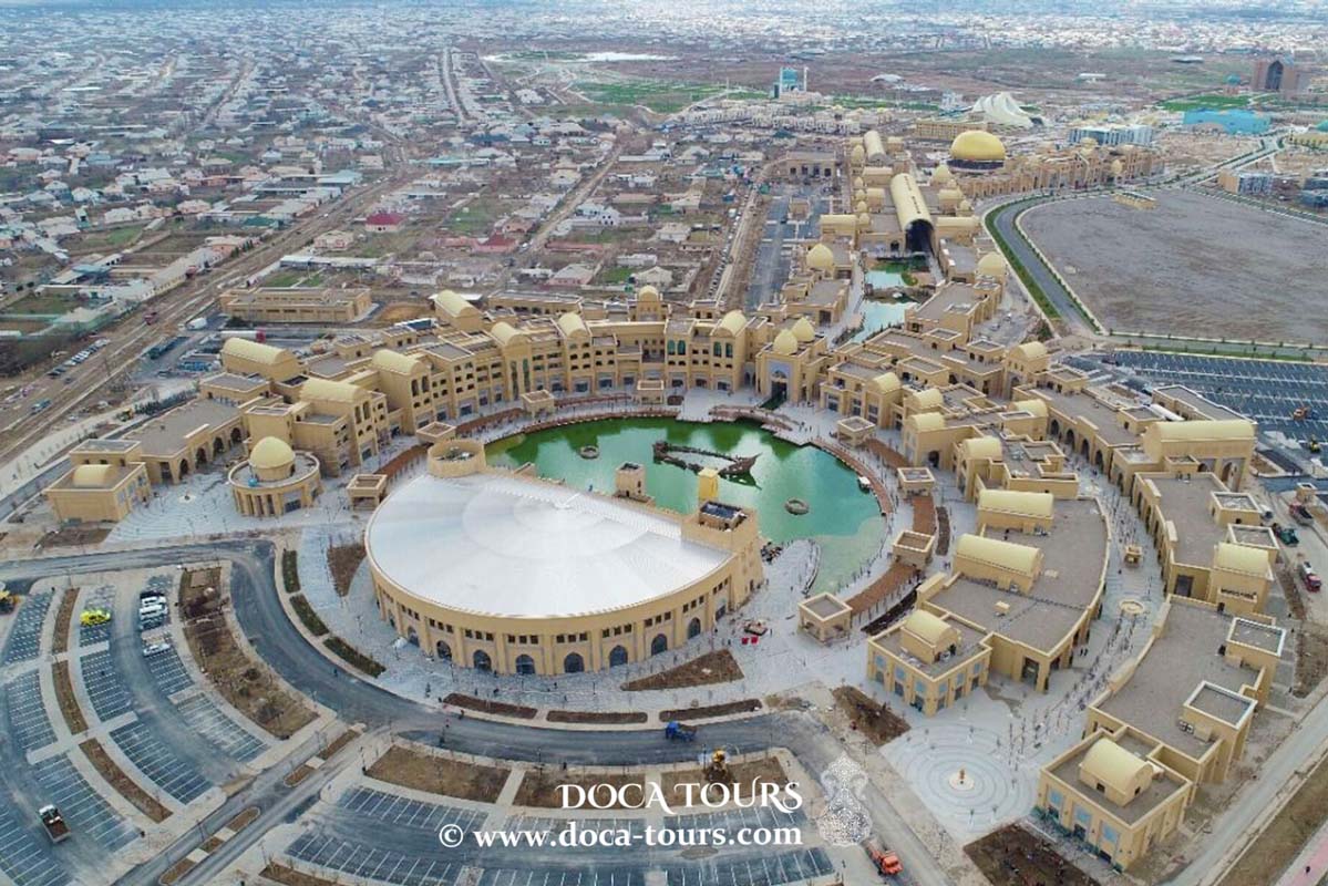
Alem Cultural and Entertainment Center: Located on Archabil Highway, this 95-meter-tall facility houses the world’s largest enclosed Ferris wheel.
Monuments
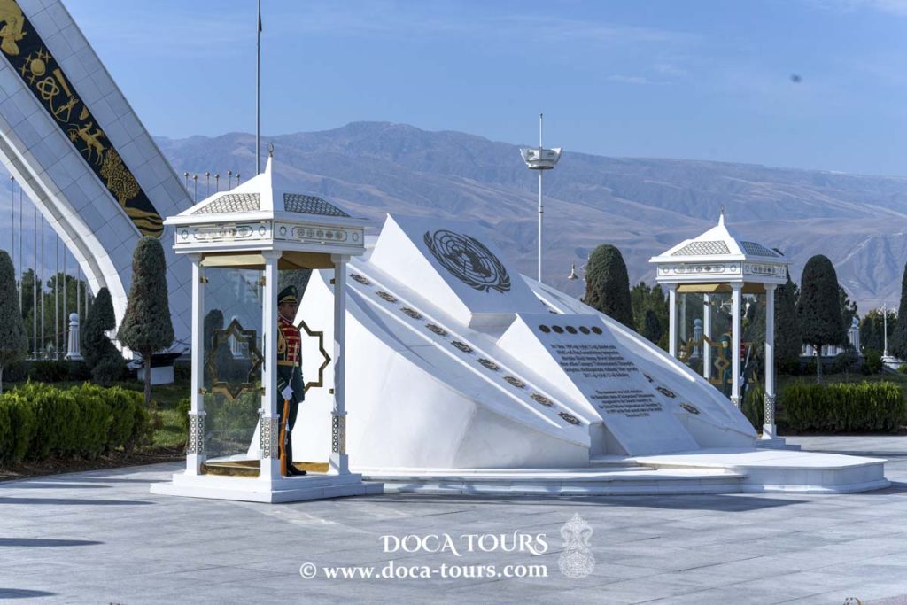
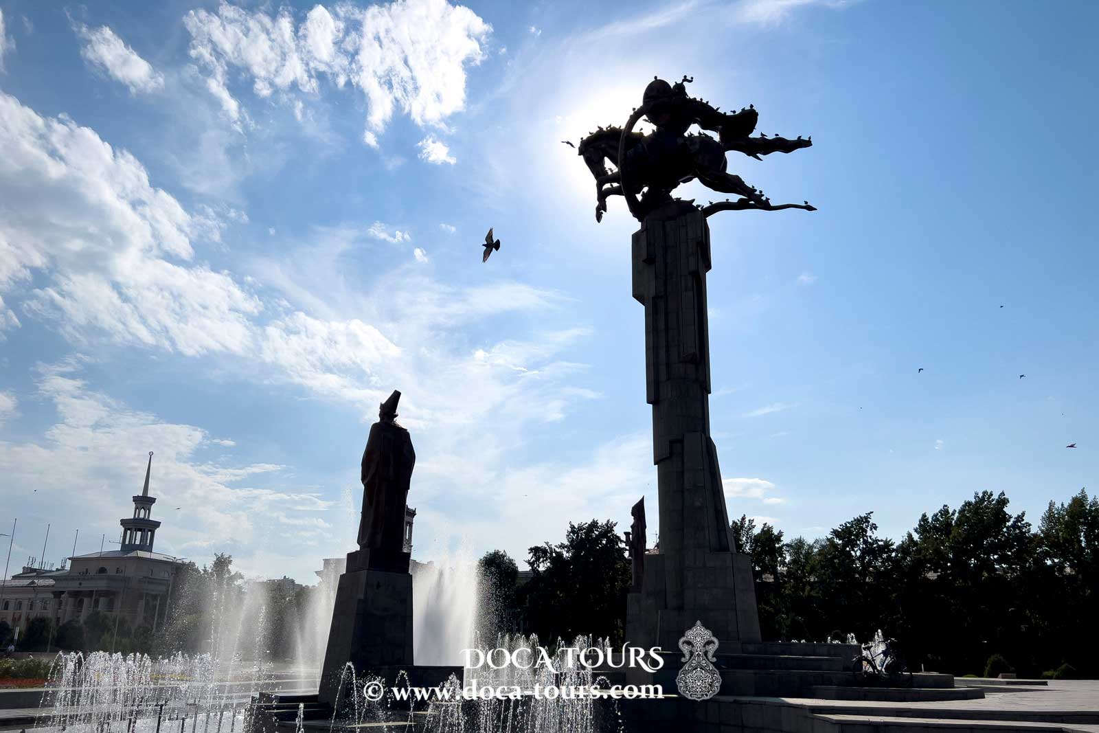
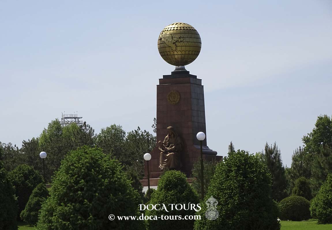
Independence Monument: Symbolizing Turkmenistan’s sovereignty.
Halk Hakydasy Memorial Complex: A memorial honoring those who perished in the Battle of Geoktepe, World War II, and the 1948 Ashgabat earthquake, located in the city’s southwest.
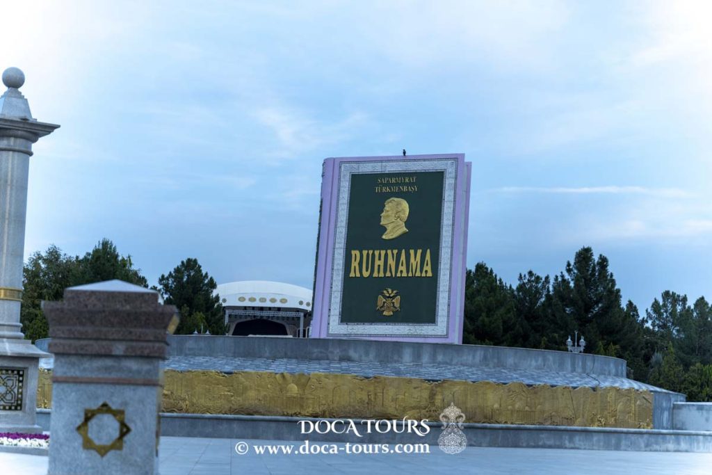
Ruhnama Monument: A giant sculpture of the sacred book Ruhnama by Saparmurat Niyazov, situated in Independence Park.
Hotels and Historical Sites
Oguzkent Hotel: A luxurious hotel operated by the Sofitel group.
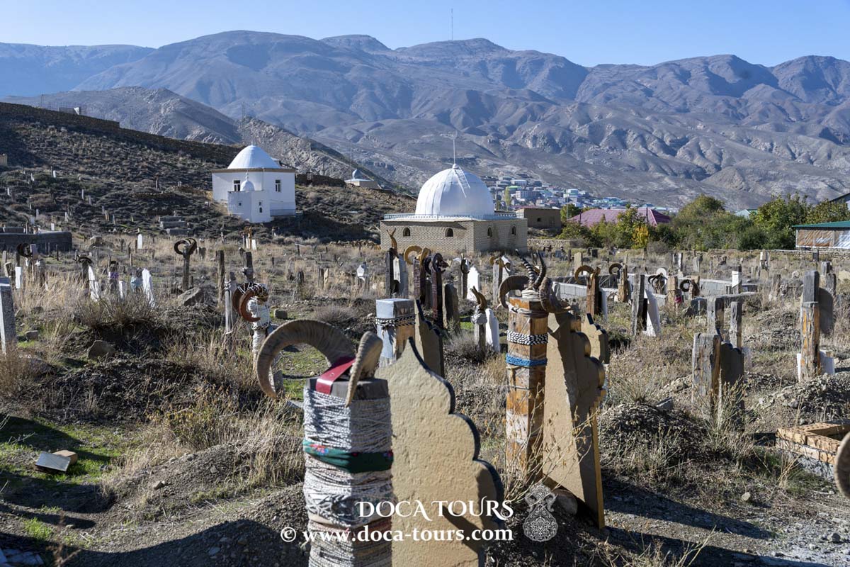
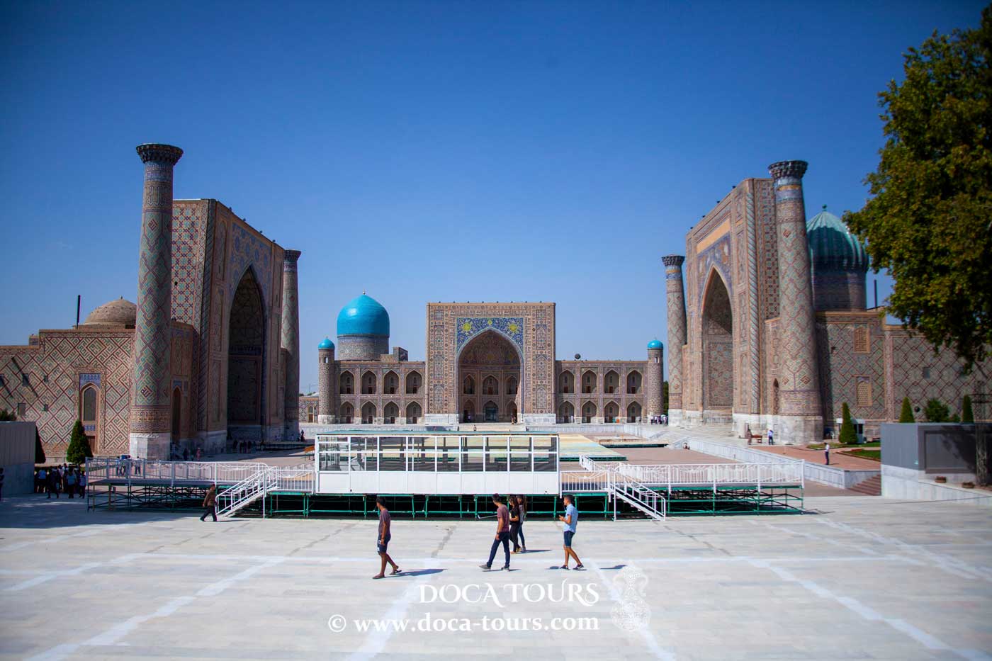
Nisa Reserve: An archaeological site featuring ancient Parthian fortresses from the 3rd century BCE to the 3rd century CE.
Unique Structures
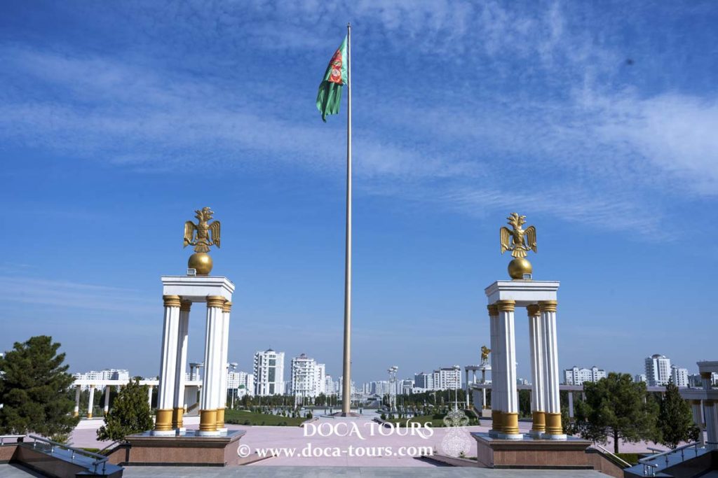
Turkmenistan National Flagpole: The fourth tallest flagpole in the world.
Oguz Khan Fountain Complex: Located at the entrance to Ashgabat’s international airport, this Guinness World Record-holding complex has the largest number of synchronized fountains (27) spread over 15 hectares. Opened in June 2008, it features sculptures of Oguz Khan, the legendary Turkic ancestor, and his six sons: Gun Khan (Lord of the Sun), Ay Khan (Lord of the Moon), Yildiz Khan (Lord of the Stars), Gok Khan (Lord of the Sky), Dag Khan (Lord of the Mountains), and Deniz Khan (Lord of the Sea).
Oguzhan Palace Complex: The presidential residence, completed in May 2011, replacing the previous smaller palace nearby.
Religious Sites
- Mosques
- Ertugrul Gazi Mosque: A Turkish-style mosque gifted by the Turkish government.
- Köşi Mosque
- Mosque in the 8th Microdistrict
- Iranian Mosque
Churches
- Cathedral of St. Alexander Nevsky: A Russian Orthodox cathedral.
- Church of St. Nicholas the Wonderworker
- Resurrection Prayer House
Mass Media
Ashgabat Television Tower
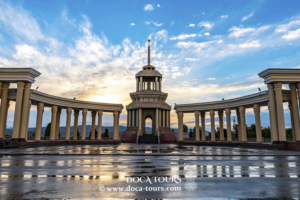
Situated on one of the ridges of the Kopetdag mountain range, the Turkmenistan Broadcasting Center is the tallest architectural structure in Ashgabat, with a height of 211 meters. Its prominent feature is the eight-pointed star of Oguz Khan, which holds the Guinness World Record as the largest architectural depiction of a star. The tower, illuminated by powerful lights at night, is visible from nearly every part of the city. On its 30th floor, there is an observation deck.
The city broadcasts seven television channels, all based in Ashgabat. The city’s dedicated channel is "Ashgabat." Radio stations broadcasting from the capital include:
Vatan (Channel 1 of Turkmen Radio, longwave frequency 279 kHz, receivable in Kazakhstan, Kyrgyzstan, Tajikistan, Uzbekistan, Georgia, Armenia, Azerbaijan, and southern Russia)
- Char Tarapdan (Channel 2)
- Miras (Channel 3)
- Oaz (Channel 4)
These stations operate on VHF, LW, MW, FM analog frequencies, and in the digital DAB+ standard (multiplexes 6B and 10B).
Twin Cities
Ashgabat is twinned with several cities around the world:
- 1974 – Bamako, Mali
- 1990 – Albuquerque, United States
- 1992 – Lanzhou, China
- 1994 – Ankara, Turkey
- 1996 – Moscow, Russia
- 2001 – Kyiv, Ukraine
- 2017 – Astana, Kazakhstan
- 2017 – Tashkent, Uzbekistan
- 2017 – Dushanbe, Tajikistan
- 2018 – Bishkek, Kyrgyzstan
- ???? – Athens, Greece
- ???? – Aktau, Kazakhstan
Diplomatic and Consular Missions
Ashgabat hosts the embassies of 30 internationally recognized countries. Among these, 28 are embassies, one is a nunciature, and one serves as an economic cooperation bureau. Additionally, the city is home to the offices of 15 international organizations.
International Organizations
Several global institutions have a presence in Ashgabat, including:
- UN Agencies (UNICEF, UNHCR)
- UN Regional Center for Preventive Diplomacy
- OSCE Center
- European Union Liaison Office
- Turkish Cooperation and Coordination Agency (TIKA)
- European Bank for Reconstruction and Development (EBRD)
- Asian Development Bank (ADB)


 According to official data from the State Committee of Turkmenistan on Statistics, as of January 1, 2012, Ashgabat was home to 12.7% of the country’s population. The 1995 census recorded a population of 604,700, which grew to an estimated 712,000 in 2001. By July 1, 2002, the population was officially estimated at 743,000, reaching 790,000 in mid-2003 (13% of the national population). On November 18, 2005, it was announced that the city's population had surpassed 900,000 (13.4% of the total population). On August 6, 2018, it was officially reported that Ashgabat’s population exceeded 1 million residents.
 In Russia, the name "Ashkhabad" continues to be used officially, as confirmed by the Russian Presidential Administration's directive No. 1495, dated August 17, 1995, which specifies the spelling of the names of former Soviet republics and their capitals.
Currently, in Turkmenistan's legislative documents (including Russian-language texts), official media, and on the capital's official websites, the city is referred to as "Ashkhabad."
Some Turkmen historians have suggested that the city's name is linked to the Arsacid (Ashkanid) dynasty of Parthian kings, with the city's origins traced back to the 3rd century BCE. However, historical evidence indicates that the city itself was founded in the 19th century as a fortress, while Nisa, located 18 km away and founded in the 3rd century BCE, served as one of the capitals of the Parthian Empire.
In Russia, the name "Ashkhabad" continues to be used officially, as confirmed by the Russian Presidential Administration's directive No. 1495, dated August 17, 1995, which specifies the spelling of the names of former Soviet republics and their capitals.
Currently, in Turkmenistan's legislative documents (including Russian-language texts), official media, and on the capital's official websites, the city is referred to as "Ashkhabad."
Some Turkmen historians have suggested that the city's name is linked to the Arsacid (Ashkanid) dynasty of Parthian kings, with the city's origins traced back to the 3rd century BCE. However, historical evidence indicates that the city itself was founded in the 19th century as a fortress, while Nisa, located 18 km away and founded in the 3rd century BCE, served as one of the capitals of the Parthian Empire.
 The city's growth accelerated in 1881 when it became the administrative center of the Transcaspian region of the Russian Empire, governed by military authorities. At that time, Ashgabat consisted primarily of clay houses surrounded by orchards. The streets were designed to be straight, with mostly single-story buildings, as a precaution against earthquakes.
In 1881, a post office was established, later upgraded to a post and telegraph office in 1889. By 1917, Ashgabat had three postal branches. In 1888, the city had become a district center with many stone buildings and wide streets. It featured numerous well-stocked shops, restaurants, and gardens. The railway station, built according to the design of academician Urlaub, was another prominent landmark.
By 1901, the population of Ashgabat was 36,500, including 11,200 Persians, 10,700 Russians, and 14,600 Armenians and others. Turkmen tribes primarily lived outside the city in nomadic settlements.
From 1881 to 1918, Ashgabat served as the administrative center of the Transcaspian region of the Russian Empire. From 1918 to 1925, it was the administrative center of the Turkestan ASSR’s Turkmen region.
In February 1925, Ashgabat (then called Poltoratsk in honor of Bolshevik Pavel Poltoratsky) became the capital of the Turkmen SSR. On February 4, 1927, the city was renamed Ashgabat, and surrounding villages were also renamed accordingly.
On October 6, 1948, Ashgabat was struck by one of the most devastating earthquakes in history. Its magnitude was 7.3, and the intensity at the epicenter reached 9–10 on the Mercalli scale. Between 90% and 98% of the city's buildings were destroyed. Casualty estimates range from 60,000 to 110,000 people, with official Turkmen sources stating 176,000 lives were lost.
In 1962, the Karakum Canal reached Ashgabat, resolving chronic water shortages.
In July 2003, Ashgabat’s street names were replaced with numerical designations, except for nine major avenues, some of which were named after Saparmurat Turkmenbashi, his parents, and the revered poet Magtymguly. The central Palace Square was numbered 2000, symbolizing the beginning of the "Golden Age" of the Turkmen people.
From September 10 to 14, 2008, an armed uprising occurred in the city, known as the "Ashgabat Rebellion." Heavy armored vehicles were deployed to suppress militants in the Khitrovka district. Witnesses reported explosions and gunfire in the city’s northern areas over the weekend. Official reports claimed the militants were involved in drug trafficking, but some independent sources suggested they were radical opposition members. Turkmen President Gurbanguly Berdimuhamedow confirmed that intelligence officers had died in the clashes.
The city's growth accelerated in 1881 when it became the administrative center of the Transcaspian region of the Russian Empire, governed by military authorities. At that time, Ashgabat consisted primarily of clay houses surrounded by orchards. The streets were designed to be straight, with mostly single-story buildings, as a precaution against earthquakes.
In 1881, a post office was established, later upgraded to a post and telegraph office in 1889. By 1917, Ashgabat had three postal branches. In 1888, the city had become a district center with many stone buildings and wide streets. It featured numerous well-stocked shops, restaurants, and gardens. The railway station, built according to the design of academician Urlaub, was another prominent landmark.
By 1901, the population of Ashgabat was 36,500, including 11,200 Persians, 10,700 Russians, and 14,600 Armenians and others. Turkmen tribes primarily lived outside the city in nomadic settlements.
From 1881 to 1918, Ashgabat served as the administrative center of the Transcaspian region of the Russian Empire. From 1918 to 1925, it was the administrative center of the Turkestan ASSR’s Turkmen region.
In February 1925, Ashgabat (then called Poltoratsk in honor of Bolshevik Pavel Poltoratsky) became the capital of the Turkmen SSR. On February 4, 1927, the city was renamed Ashgabat, and surrounding villages were also renamed accordingly.
On October 6, 1948, Ashgabat was struck by one of the most devastating earthquakes in history. Its magnitude was 7.3, and the intensity at the epicenter reached 9–10 on the Mercalli scale. Between 90% and 98% of the city's buildings were destroyed. Casualty estimates range from 60,000 to 110,000 people, with official Turkmen sources stating 176,000 lives were lost.
In 1962, the Karakum Canal reached Ashgabat, resolving chronic water shortages.
In July 2003, Ashgabat’s street names were replaced with numerical designations, except for nine major avenues, some of which were named after Saparmurat Turkmenbashi, his parents, and the revered poet Magtymguly. The central Palace Square was numbered 2000, symbolizing the beginning of the "Golden Age" of the Turkmen people.
From September 10 to 14, 2008, an armed uprising occurred in the city, known as the "Ashgabat Rebellion." Heavy armored vehicles were deployed to suppress militants in the Khitrovka district. Witnesses reported explosions and gunfire in the city’s northern areas over the weekend. Official reports claimed the militants were involved in drug trafficking, but some independent sources suggested they were radical opposition members. Turkmen President Gurbanguly Berdimuhamedow confirmed that intelligence officers had died in the clashes.