


Film 1: https://www.youtube.com/watch?v=bZiqPlllq-s&t=94s
Film 2: https://www.youtube.com/watch?v=CZ6W2huLGBA&t=58s
Until 1960, the Aral Sea was the second largest inland endorheic lake in the world, second only to the Caspian Sea, and the fourth largest lake overall, following Lake Victoria (Tanzania, Kenya, Uganda), Lake Superior (Canada, USA), and the Caspian. By the 2000s, experts began warning that this once-mighty body of water was transforming into a new desert known as the Aralkum.
Located in the northern desert region of Central Asia, within Uzbekistan and Kazakhstan, the Aral Sea originally spanned an area of 68,000 square kilometers with a water volume exceeding 1,060 cubic kilometers. Its vastness often earned it the title of a sea.
About 4,000 years ago, the Amu Darya River began flowing north into the massive Aral Depression, which also received waters from the Syr Darya River. At that time, the depression was a vast plain with a complex topography, bounded by the Ustyurt Plateau cliffs to the west, the Priaral Uplands to the north, the Betpak-Dala Desert and Karatau Range to the east, and the Karakum and Kyzylkum Deserts to the south. The area around the Amu Darya’s mouth was called Aral, a name that eventually came to denote the entire lake.
During Alexander the Great’s era, the Aral Sea was known as the Oxian Sea, after the old name of the Amu Darya, the Oxus. Written references date back to the 9th–11th centuries when Arabs called it the Khwarezm Sea after the ancient state of Khwarezm.
In its natural state, the Aral Sea’s surface was 53 meters above sea level, almost 80 meters higher than the Caspian Sea. Before its decline in the 1960s, the Aral stretched 428 km in length and 234 km in width, with a maximum depth of 69 meters.

During summer, surface water temperatures ranged between 26 and 30°C, while in winter, they dropped below zero, and the sea was covered by ice. The average salinity was 10–11‰, and water transparency reached up to 25 meters. The northern shores were steep and rugged, with deep bays, while the eastern shores were low, sandy, and interspersed with small bays and islands. The southern shore consisted of the Amu Darya delta, and the western shore was bordered by the Ustyurt cliffs, rising 180–200 meters high.
The Great and Small Seas
Until 1990, the Aral Sea was divided into two main, unequal parts—referred to as the Great Sea and the Small Sea—connected by the Berg Strait. The region’s climate was predominantly arid and continental, with northern areas experiencing continental climate and southern areas characterized by subtropical conditions.
The Aral Sea’s water balance comprised an inflow (precipitation) of 8.7 cubic kilometers, river runoff of 5.5 cubic kilometers, and level changes of 0.6 cubic kilometers. Outflows included evaporation of 63.8 cubic kilometers. Although endorheic, the Aral received significant water inputs from Central Asia’s two largest rivers: the Amu Darya and Syr Darya.
Before 1961, the Aral Sea contained 1,100 islands larger than 0.01 square kilometers, with a total area of 2,230 square kilometers. These included 12 major islands like Barsakelmes, Kokaral, Lazarev, and Vozrozhdeniya (Resurrection) Island. The islands, of continental origin, were concentrated along the eastern shores. The southern part contained the Akpetkin (Karabayly) Archipelago, comprising over 50 islands formed by partially submerged sandy ridges of the Kyzylkum Desert.
The largest island, Barsakelmes, translates from Kazakh as “go and never return.”
As the Aral dried up, islands in the Akpetkin Archipelago were the first to connect with the mainland, and the bays separating them turned into salt flats. By 1990, Kokaral Island disappeared, merging with the mainland, and along with it, the Saryshyganak Bay vanished.
The areas of remaining islands expanded, and within a decade, all islands connected to the mainland, dividing the Great Sea into two distinct water bodies—western and eastern. Since the 1960s, the degradation of vegetation, particularly trees and shrubs, was observed. Reeds and licorice fields diminished, poplars disappeared, and oleasters withered.
Habitats of muskrats disappeared, hunting species drastically declined, and most waterfowl migrated northward to the lakes of the Turgay Basin.
Economic Importance of the Aral Sea
The Aral Sea’s economic role revolved around fishing, with annual catches reaching 40,000–50,000 tons, including over 20,000 centners of the valuable Aral barbel. Until the 1960s, the Aral ranked third among the USSR’s inland fisheries, providing about 13% of its total fish catch. The primary commercial species included bream, common carp, shamaika, roach, zander, and asp, constituting 80% of the total catch. The Aral salmon, listed in the Red Book of endangered species, was also found here.
By 1980, increased salinity, rising from 11‰ to 20‰, and the drying of old river channels leading to spawning grounds reduced fish catches to 14,000 tons. Soon, fishing in the Aral Sea ceased almost entirely.
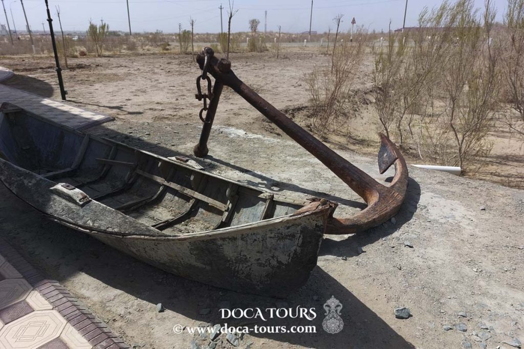
Until 1960, the Aral Sea played a vital role in connecting the ports of Aralsk and Muynak, with cargo traffic reaching 250,000 tons annually, primarily cotton, grain, salt, fish, chemicals, and timber.
Water levels served as an accurate indicator of the ecosystem’s health. Signs of imbalance began to manifest in 1960, primarily due to large-scale regulation of the Amu Darya and Syr Darya rivers for irrigation, which drastically reduced water inflows into the Aral. This regulation supported vast cotton fields and rice paddies in the former USSR but led to the sea’s decline.
Cotton and Agriculture Expansion
Cotton and rice cultivation caused irrigated areas in the Amu Darya and Syr Darya basins to expand from 4.1 million hectares in 1960 to 7.4 million hectares in 1990. These fields supplied 95% of the USSR’s cotton, 40% of its rice, 25% of its vegetables and melons, and 32% of its fruits and grapes.
This agricultural expansion drastically reduced river inflows into the Aral Sea—from an average of 62 cubic kilometers annually in 1910–1960 to 16.7 cubic kilometers in 1971–1980, and further down to 3.5 cubic kilometers in 1981–1990. Consequently, the sea level dropped rapidly.
In the 1960s, the Aral Sea’s water level declined at an average rate of 0.2 meters per year, accelerating to 0.6 meters per year in the 1970s and 0.85 meters per year in the 1980s. By early 1987, the water level had dropped to 36.4 meters, which was 16.6 meters below the long-term average level before 1961. Between 1975 and 1988, the Karakum Canal received between 10 and 13.5 cubic kilometers of water annually from the Amu Darya, enabling the irrigation of approximately 850,000 hectares. Significant volumes of water were also diverted via the Amu-Bukhara and Karshi Canals. Meanwhile, the Syr Darya waters irrigated vast areas of the Fergana Valley and the southeastern regions of Uzbekistan and Kazakhstan.
Most irrigation water did not return to the rivers but was instead discharged into drainage systems, contributing to desertification and environmental pollution.
The total volume of drainage water from the Amu Darya and Syr Darya basins amounted to 32.71 cubic kilometers per year. This resulted in the formation of two large satellite water bodies: Sarykamysh and Arnasay. Arnasay emerged in the area of the Aydar salt flat and other nearby basins. Irrigation and drainage waters were directed into these reservoirs from the Hungry Steppe and the Chardarya Reservoir.
The dried seabed of the Aral Sea became a source of intense dust storms, spreading dust over distances of 150 to 500 kilometers. Annually, between 15 and 75 million tons of dust, containing toxic sulfate and chloride salts, were lifted from the southeastern shores. This negatively affected plant health and significantly reduced agricultural crop yields.

As dust storms increased, atmospheric turbidity nearly tripled, impacting solar radiation diffusion and soil temperatures.
The Aral Sea played a crucial role in moderating the climate of the surrounding Priaralye region by absorbing heat in summer and releasing it in winter. By the late 20th century, this moderating effect had halved. Winds carried salts from the sea, and by the early 2000s, the remaining water contained about 10 billion tons of salt. If this salt were spread in a 5-centimeter-thick layer, it would cover an area of approximately 10 million hectares. The transportation of such large amounts of salt into irrigated areas posed a severe threat, as salt dust reduced agricultural productivity and damaged ecosystems. Before the eyes of the Priaralye inhabitants, a new desert, the Aralkum, was forming.
In 1987, a meeting of a specially created government commission on the ecological situation in the Aral Sea basin, led by Academician Yuri Izrael, was convened. Additionally, a government commission was established to develop proposals for improving water supply for economic needs, chaired by the vice-president of the USSR Academy of Sciences, Academician Valentin Koptyug.
A state commission in Nukus began investigating the ecological and sanitary conditions of the Aral Sea’s shores, under the leadership of Y. Izrael, chairman of the USSR State Committee for Hydrometeorology. A group of scientists from the Institute of Water Problems of the USSR Academy of Sciences sent a letter to the Central Committee of the Communist Party of the Soviet Union, expressing concern about the water supply conditions in the Central Asian republics. The USSR Ministry of Land Reclamation and Water Resources established basin water management organizations, “Amu Darya” and “Syr Darya.”
Meanwhile, the Aral Sea’s water level dropped further to 40.29 meters. Its volume decreased to 401 cubic kilometers, the water surface area shrank to 41,100 square kilometers, and salinity exceeded 20 grams per liter.
Urgent Measures
In 1989, the Supreme Soviet of the USSR adopted a resolution titled “On Urgent Measures for the Ecological Rehabilitation of the Country.” The resolution acknowledged that the situation in the Aral Sea region had spiraled out of control, designating the Priaralye area as an ecological disaster zone. In accordance with this resolution, the Council of Ministers of the USSR established the Aral Research and Coordination Center, headed by Vladimir Kotlyakov, Director of the Institute of Geography of the USSR Academy of Sciences. Another decree by the Council of Ministers initiated work on artificially increasing precipitation in the mountain regions of Central Asia to restore the water resources of the Amu Darya, Syr Darya, and the Aral Sea.
Meanwhile, the Great Sea completely separated from the Small Sea, and the Aral Sea’s water level fell to 39.08 meters. The Supreme Soviet of the USSR formally declared the Priaralye region an ecological disaster zone. Similarly, the Supreme Soviet of the Turkmen SSR adopted a resolution titled “On the Environmental State of the Priaralye Territories of the Turkmen SSR and Measures for Their Improvement,” which identified the Tashauz Region and the Dargan-Atinsky District of the Chardzhou Region as ecological disaster zones.
In 1992, UNESCO, in collaboration with the German Federal Ministry of Education and Research, launched the first phase of a project on ecological studies and monitoring of the Aral Sea delta, which continued until 1996.
In August of the same year, an International Scientific and Practical Conference was held in Nukus to address the ecological catastrophe of the Aral Sea. The conference brought together presidents of the Academies of Sciences of Central Asia, along with approximately 100 scientists and specialists from Russia, the United States, Japan, Germany, the Netherlands, and other developed nations. The conference resulted in a resolution and an appeal to the United Nations, Central Asian presidents, governments, and parliaments, urging them to declare the Priaralye region an ecological disaster zone and establish an international body to coordinate efforts to save the Aral Sea.
Additionally, the Soviet bioweapons testing site on Vozrozhdeniye (Resurrection) Island, which after the dissolution of the USSR became shared by Uzbekistan and Kazakhstan, was closed. The Aral Sea’s water level had fallen to 37.20 meters.
In January 1994, the heads of Central Asian states approved the “Program of Concrete Actions to Improve the Ecological Situation in the Aral Sea Basin for the Next 3–5 Years Considering the Socioeconomic Development of the Region” (PBA-1).
The program’s development actively involved representatives from the United Nations Development Programme (UNDP), the United Nations Environment Programme (UNEP), the World Bank, the European Bank for Reconstruction and Development (EBRD), and other international financial institutions. The program’s primary objectives were to stabilize the ecological situation in the Aral Sea Basin, restore the Priaralye ecosystem, improve water and land resource management, and establish administrative structures for planning and implementing the program’s initiatives.
The program encompassed eight components, based on the following concepts:
“Regional Water Resource Management Strategy,”
“Ensuring the Stability of Dams and Reservoirs,”
“Hydrometeorological Services,”
“Regional Environmental Information System,”
“Water Quality Management,”
“Restoration of Wetlands,”
“Rehabilitation of the Northern Aral Sea,” and
“Ecological Research in the Aral Sea Basin.”
The program also included projects such as regulating the Syr Darya River flow and developing its delta, along with initiatives to ensure access to clean water, improve sanitation, and enhance public health in Uzbekistan, Turkmenistan, and Kazakhstan. It also provided for medium-term water supply projects, integrated water and land resource management in the upper watershed, and real-time water resource management and capacity building.
The program outlined measures for modernizing production and improving infrastructure to support the socioeconomic development of the Priaralye region, including the Autonomous Republic of Karakalpakstan and the Khorezm Region, with a total budget of $2.29 billion.
In 1997, during a meeting of Central Asian heads of state on the issues of the Aral Sea, the Almaty Declaration was signed. As part of the restructuring of existing intergovernmental organizations, the International Fund for Saving the Aral Sea (IFAS) was reorganized. The President of Uzbekistan, Islam Karimov, was elected as the Fund’s president. A permanent executive body of the Fund, the IFAS Executive Committee, was also established in Tashkent, with branches in other Central Asian countries.
In 2001, large-scale geological exploration began in search of oil in the Aral Sea region. Drilling in the northern part of the sea was conducted by Kazakhstan Caspian Shelf JSC, while exploration on the western shore was carried out by the joint venture Kulandy Energy Corporation. By this time, the water level in the Aral Sea had already fallen to 32.16 meters.
In December 2008, the International Fund for Saving the Aral Sea (IFAS) was granted observer status in the United Nations General Assembly. Between 2003 and 2010, member countries of the Fund invested over $2 billion in implementing various projects. To finance more than 300 projects under the third action program (2011–2015), developed by the IFAS Executive Committee in collaboration with the United Nations, the World Bank, the Asian Development Bank, the European Union, and several donor countries, a budget of over $8.5 billion was allocated.
In November 2014, Krymbek Kusherbayev, the Akim (Governor) of the Kyzylorda Region of Kazakhstan, stated: “The northern part of the Aral Sea will soon be restored.” He noted that this was the first case in human history where a dying sea was revived due to the efforts of the president, who had signed an agreement with the World Bank. According to him, the salinity level in the water had decreased from 21 g/L to 17 g/L. Fishermen, who had previously relocated to Balkhash and Kapchagay, returned to the Aral. Eight fish processing plants were already operating in the Priaralye region, with fish production reaching 6,000 tons. The number of fish species increased from one to 27. Over the past ten years, 56,000 hectares of saxaul and other vegetation had been planted to prevent dust storms.
Between 2015 and 2018, the government of Uzbekistan estimated the necessary costs for mitigating the consequences of the Aral Sea disaster and restoring the region at $4.3 billion. Under a government-approved program, $1.09 billion was allocated for improving water resource management, $321.2 million for expanding employment opportunities, $433.7 million for improving public health, and $158 million for restoring ecosystems and biodiversity.
Thank you very much for your attention.

Subscribe to the channel and don’t forget to like our videos.
#aral sea, #sand, #aral, #central asia, #uzbekistan, #sea, #desert, #ecology, #nature, #asia, #travel, #catastrophe, #landscape, #coast, #disaster, #moynaq, #dry, #climate, #lake, #boat, #karakalpakstan, #apocalypse, #abandoned, #environment, #water, #ship, #background, #beach, #sky, #arid, #outdoor, #kazakhstan, #shipwreck, #rust, #earth, #climate change, #outdoors, #tourism, #rusty, #muynak, #dead, #desolation, #destruction, #tragedy, #global warming, #ocean, #vessel, #fishing boat, #drought, #horizon