


Video: https://www.youtube.com/watch?v=71iaGiVMNZg&t=11s
Turkmenistan is a beautiful country and the second-largest country in Central Asia after Kazakhstan. The country covers an area of approximately 491,210 km2.
Almost 95% of the land is occupied by the Karakum Desert, which consists of both sand and gravel desert areas. In the west, you’ll find the Türkmenbaşy Plateau and the Great Balkan Mountains (1880 m).
Today, our journey takes us to the Yangi Kala Canyons in Turkmenistan. We started our trip from the city of Balkanabat, heading towards Yangi Kala.
Balkanabat is the capital of the Balkan Province in western Turkmenistan, with a population of 108,000 (as of 2011).
The city is located about 600 km northwest of the capital, Ashgabat. It was founded in 1933 as a station on the Trans-Caspian Railway and was called Nefte-Dag (from the Russian word “neft,” meaning oil) until 1946. From 1946 to 1999, it was known as Nebit-Dag before receiving its current name. The city is an industrial hub for oil and natural gas processing.
Early in the morning, we set off towards the Yangi Kala Canyon. The distance from Balkanabat to Yangi Kala is approximately 160 km.
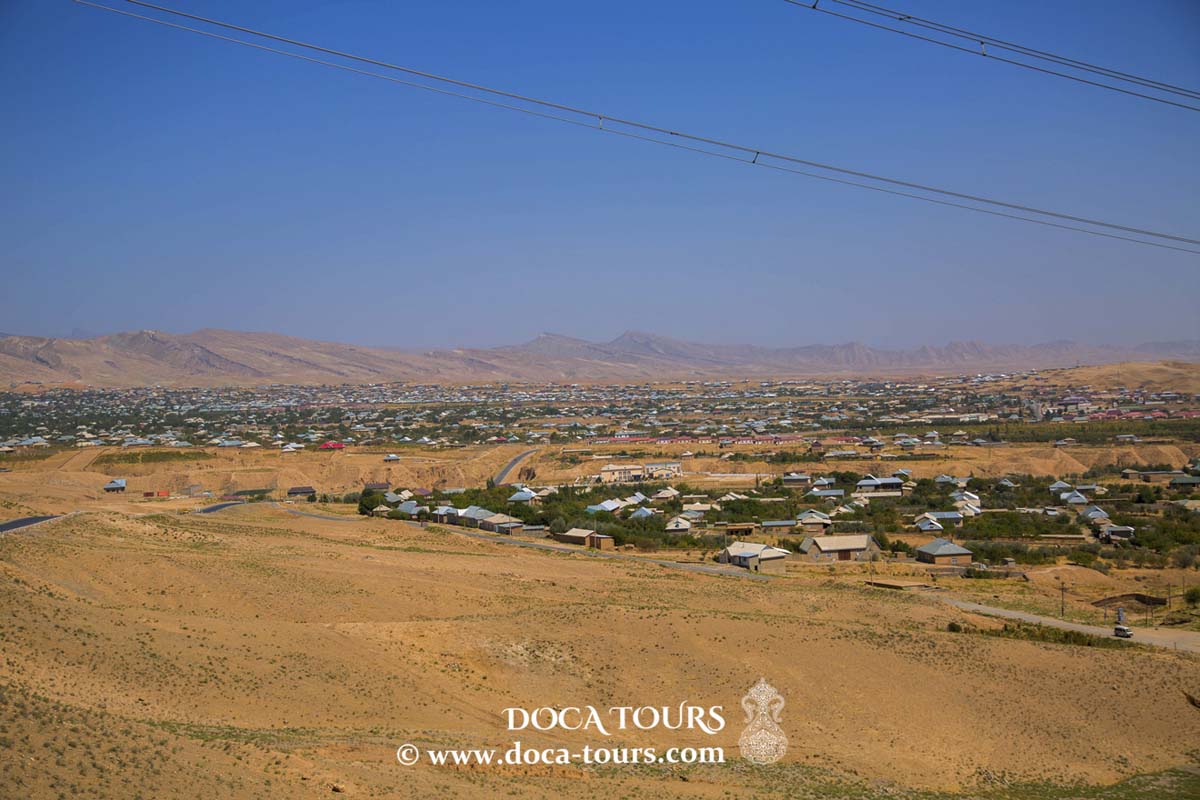
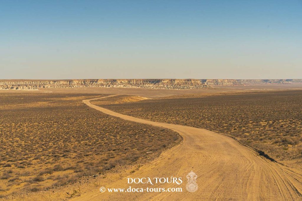
We drove about 130 km through the desert, passing small desert settlements. Then we reached a point where the view of a new geological landscape was stunning, and the asphalt road ended.
We continued along desert tracks in our four-wheel drives. The view of the Yangi Kala Canyons was simply breathtaking!
At the same time, the presence of an asphalt road makes visiting Yangi Kala much easier than having to navigate abandoned unpaved roads. It’s worth mentioning that this is the only asphalt road (with branches) covering an area of several tens of thousands of square kilometers. Interestingly, this single road passes just a few kilometres from Yangi Kala.
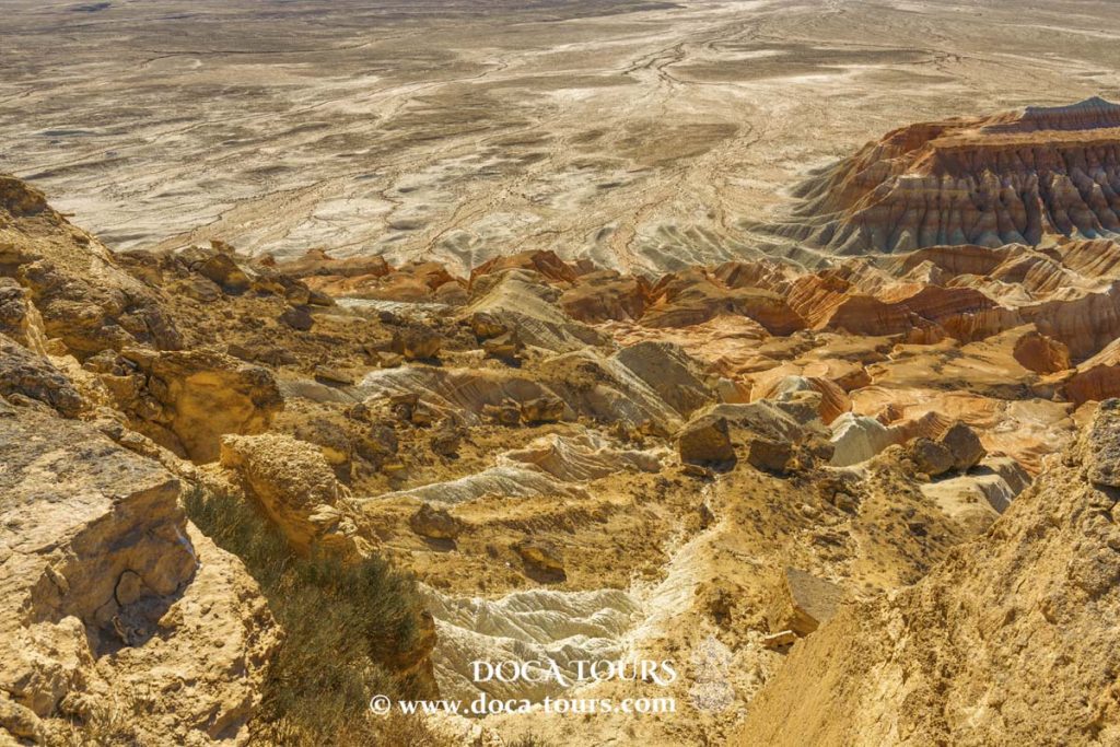
The name “Yangi Kala Canyon” translates literally to “Fire Fortresses,” an apt description of this stunning 24-kilometre-long section in northwestern Turkmenistan, often referred to as the “Grand Canyon of Central Asia.” These impressive rainbow-coloured rocks, shaped over millennia by the sea, wind, and rain, appear surreal in the golden rays of the setting sun.
Surprisingly, very few travellers make it to this canyon, which is why it has retained its isolated, pristine tranquillity to this day.
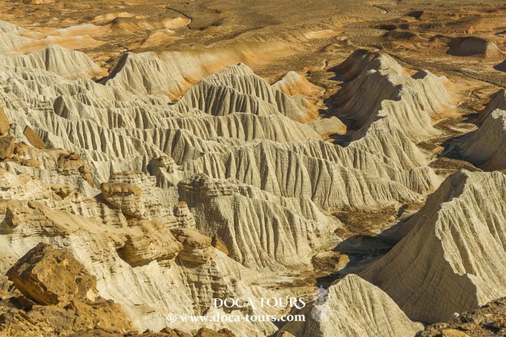
Yangi Kala resembles a gigantic and impregnable fortress, created centuries ago by nature itself, using layers of red, white, yellow, and orange. The rocks in the canyon are predominantly red, which is why locals often call it Kyzyldag (Red Mountains).
In ancient times, the canyon was flooded by the waters of the Kara-Bogaz-Gol Bay, so particularly lucky travellers may still find fossilised shells and stones with mysterious shapes and olors. Many of those fortunate enough to admire Yangi Kala remark on the rare beauty of the echo, which repeatedly reflects the enthusiastic shouts of tourists.
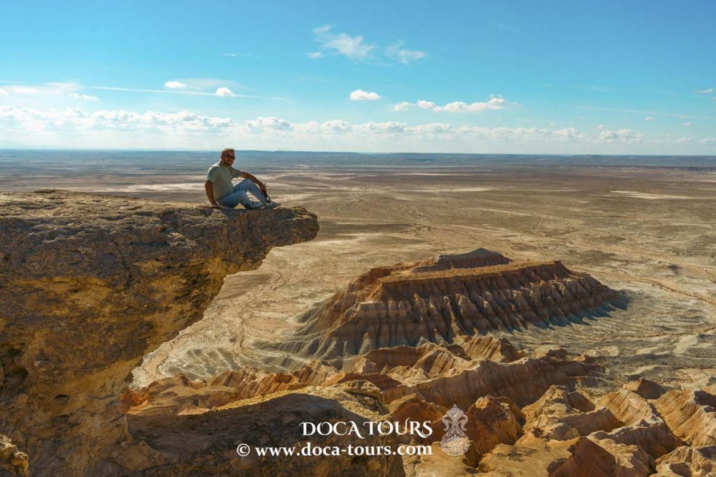
The most famous spot in Yangi Kala where all tourists must take a photo is an unnamed peak at 267 meters. It is also the dominant (highest) point in the area. The height difference of the slopes is 100-150 meters.
Unfortunately, the term “Yangi Kala Canyon” has become firmly established in everyday use, though it’s a completely inaccurate definition. A canyon is a narrow river valley with steep, critical slopes. Often, a river or a dry riverbed occupies the entire floor of a canyon. Typical examples include the Grand Canyon in the USA or the Fish River Canyon in Namibia.
The geology of Yangi Kala has nothing to do with canyon or river channel activity. The formation of steep banks is the result of abrasion processes in the Caspian Sea, whose shoreline was once near Yangi Kala. Waves and surf in the coastal area eroded the rocks over a long period, forming these very bizarre relief shapes.
Getting there is only possible with private transportation, as there is no regular public transport to the area.
On the way to this natural wonder, you may spot shapes resembling different animals or palaces in the cliff faces, depending on how imaginative you are.
It is definitely worth visiting these stunning canyons.
We spent three hours there, had a picnic, and enjoyed the breathtaking views.
If you book a trip through DOCA TOURS, we can organise such wonderful journeys to the natural wonders of Central Asia for you.
Thank you very much for your attention. Travel with DOCA TOURS.
We will organise the best trips of your life through Central Asia.
Discover Turkmenistan with DOCA TOURS.
Thank you very much for your attention.
Subscribe to the channel and don’t forget to like our videos.
#turkmen, #scenery, #stone, #riverbed, #outdoor, #old riverbed, #old, #nature, #tour, #tourism, #landscape, #travel, #attraction, #turkmenistan, #fiery fortress, #valley, #dry, #destination, #desert, #crocodiles mouth, #yangykala canyon, #canyon, #balkan, #sand, #turkmenistan map, #view, #tethys sea, #yangykala, #sea, #ancient, #scenic, #mountain, #rocky, #rock, #landmark, #canyons, #limestone, #adventure, #panoramic view, #texture, #touristic, #hiking, #geology, #desert landscape, #colorful, #central asia, #bizarre, #trekking, #natural, #turkmenbashi