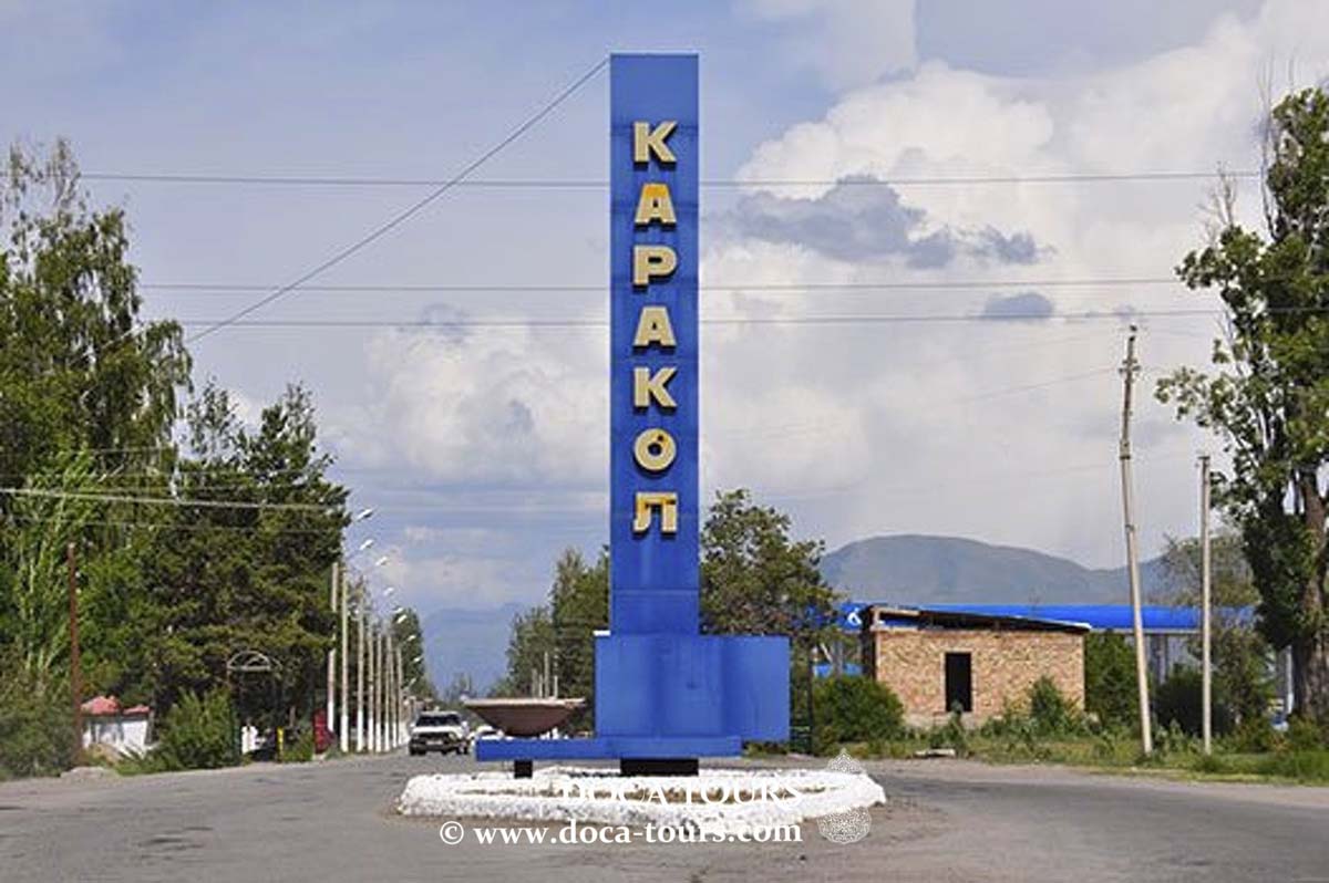
ERKESHTAM
- Geographical coordinates: 39°41′N 73°55′E
- Elevation: 2,950 m
- Common Languages: Kyrgyz, Russian
- Time Zone: UTC+6
- Vehicle Registration Code: 06
Erkeshtam, known as Irkeshtam in Chinese and Dungan, or Erkech-Tam in Uyghur and Kyrgyz, is a border crossing between Kyrgyzstan and Xinjiang, China. It is named after a village on the Kyrgyz side of the border in the southern part of Osh Region. The border crossing is also called Simuhana, after the first settlement on the Chinese side, but Erkeshtam has become the more commonly used name in both countries.

Erkeshtam is the westernmost border crossing in China. It is one of two border crossings between Kyrgyzstan and China, the other being Torugart, which is about 165 km (103 miles) to the northeast.
Location
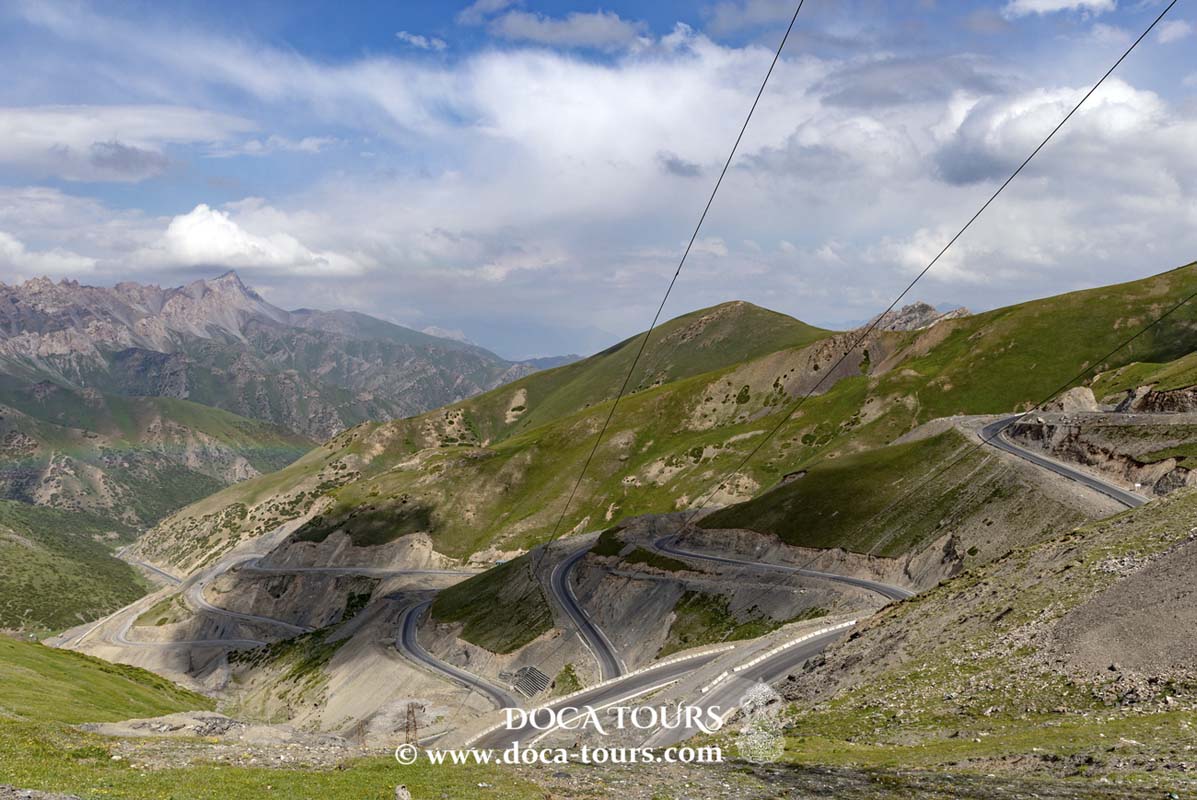
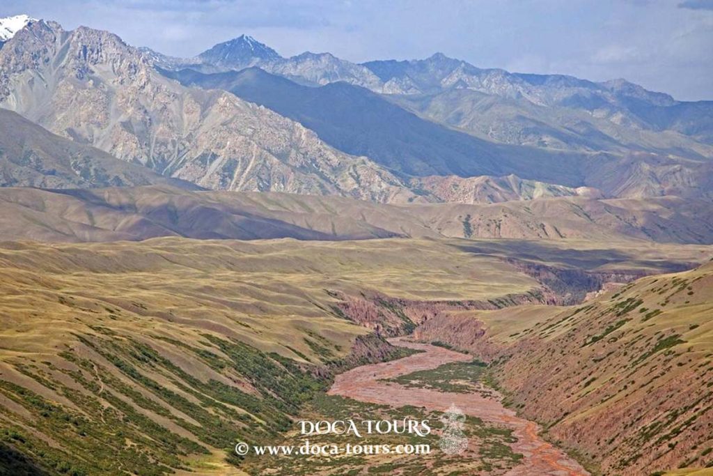
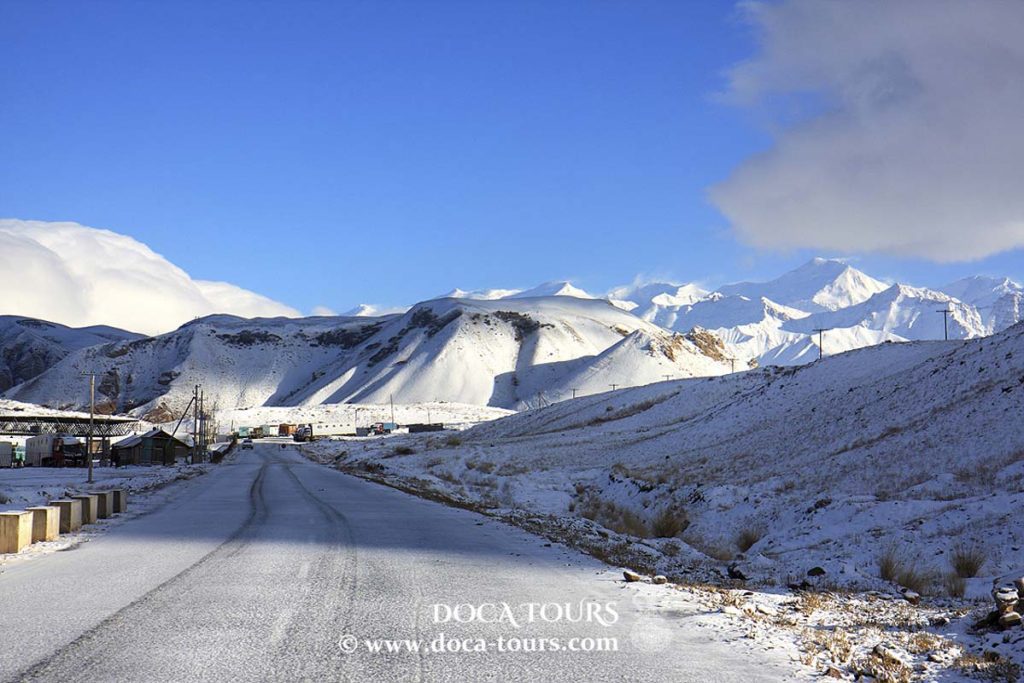
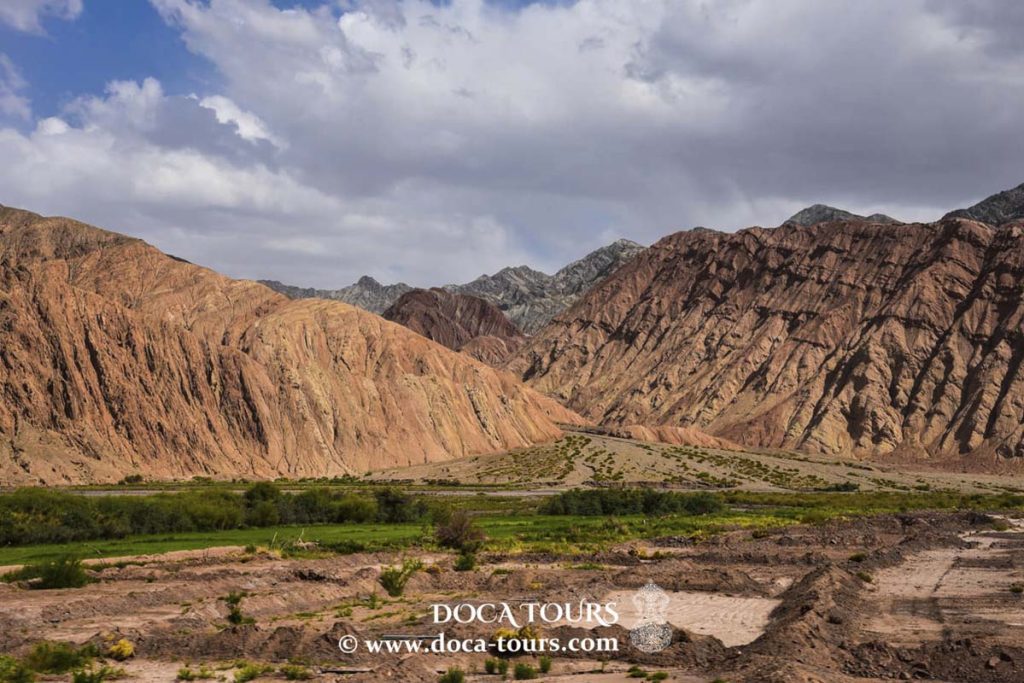
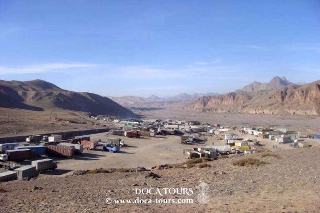
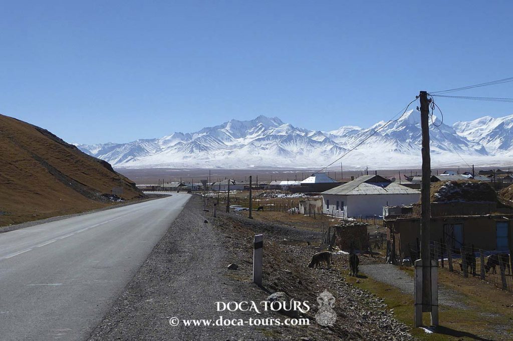
The Erkeshtam border crossing is located approximately 230 kilometers (140 miles) west of Kashgar, 250 kilometers (160 miles) southeast of Osh, and 550 kilometers (340 miles) east of Dushanbe, Tajikistan. The crossing passes through the Erkeshtam Pass, a deep gorge where the southern slopes of the Tian Shan meet the Pamir Mountains. The altitude of the gorge is approximately 2,950 meters (9,680 feet) above sea level. The village of Erkeshtam is situated about 2 kilometers (1.2 miles) from the Kyrgyz-Chinese border. Both Erkeshtam and the village of Simuhana, located about 3.5 kilometers (2.2 miles) on the Chinese side of the border, lie along the East Kyzyl-Suu River. Simuhana belongs to Ulugqat County, which is part of the Kizilsu Kyrgyz Autonomous Prefecture in Xinjiang.
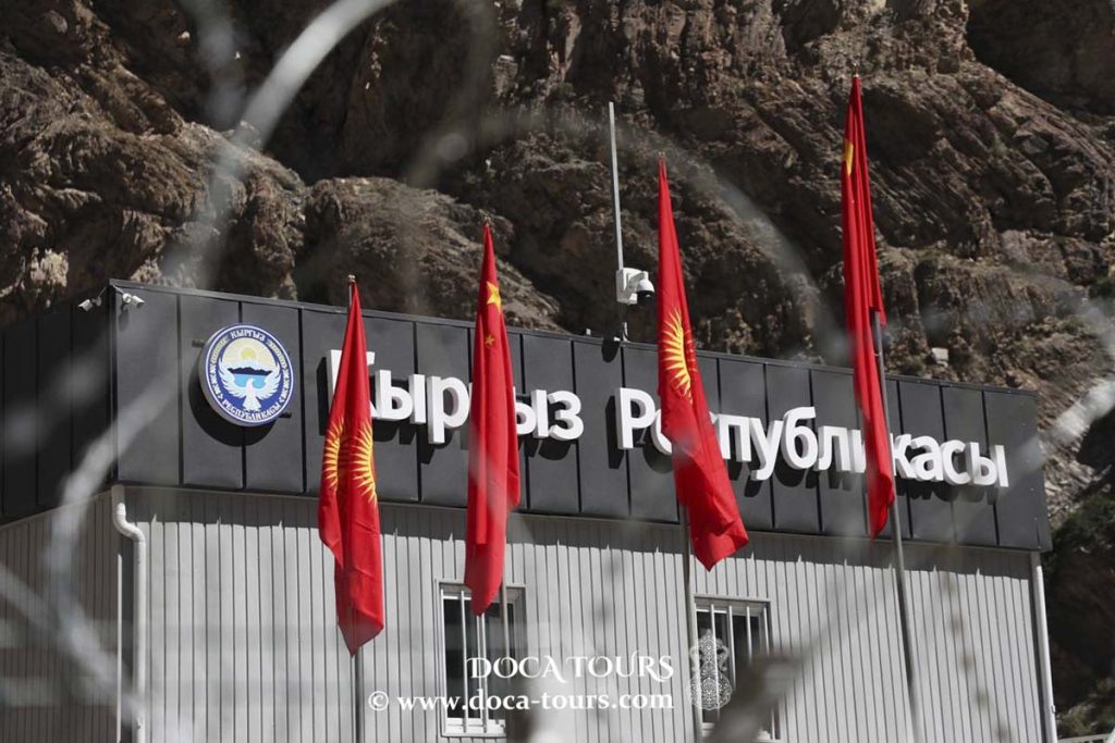
Border Crossing at Erkeshtam
The Erkeshtam border crossing oversees major trade routes connecting the Tarim Basin to the east with the Alay and Fergana Valleys to the west and north. On the Kyrgyz side of the border, the A371 road (now EM-05) heads west, initially crossing the Erkeshtam Pass (3,005 meters), followed by the old Taldyk Pass (also known as Taukmuurun or Tongmuurun) (3,536 meters) or the new Silk Road Pass (3,760 meters) into the Alay Valley. At Sary-Tash, the A371 (now EM-05) intersects with the M41 highway, leading north through the Taldyk Pass (elevation 3,615 meters or 11,860 feet) towards Osh and the Fergana Valley. On the Chinese side, the G3013 expressway from Kashgar to Irkeshtam heads east towards Kashgar and the Tarim Basin via Ulugqat. From the border to Gansu, the road is designated G581, connecting to G30 in Ulugqat, which is China's longest expressway, stretching 4,243 kilometers to the Pacific Ocean.
The Asian Highway AH65, which runs from Termez, Uzbekistan, to Kashgar, China, passes through Erkeshtam. The European Route E60, originating in Brest, France, ends at Erkeshtam.
A bus service operates across the pass on Mondays and Tuesdays.
History
Erkeshtam, located at a natural dividing line between significant geographical and cultural regions, has been an essential border checkpoint for millennia. During the Han Dynasty and the Three Kingdoms period (the second third of the 3rd century AD), it was known as Juandu. According to the Book of Han, Juandu had "380 households, 1,100 people, and 500 people capable of bearing arms," with inhabitants originally belonging to the Sai race, who wore Usun clothing, followed "water and pastures," and stayed close to the "Congling" (Pamir Mountains).
Historians believe Erkeshtam to be the Hormeterium, a trading station mentioned by Ptolemy in his treatise "Geography." Some scholars have further speculated that it could be one of several possible locations referred to as the Stone Tower by Ptolemy. He specifically noted that Hormeterium was located 5 degrees east. Below is an excerpt from "Geography," where Ptolemy provides coordinates for the Stone Tower (which was under the control of the Sai or Sakai people, with the mentioned Komedai likely being the Alay Valley).
After Imperial Russia took control of Central Asia, a horse path from Osh to Erkeshtam was established in 1893.
In 1934, Khoja Niyaz, the nominal leader of the First East Turkestan Republic (ETR), was expelled from Kashgar by the Hui warlord Ma Zhongying and retreated through Erkeshtam. There, he signed an agreement to dissolve the ETR and pledged support for the Soviet-backed Sheng Shicai government in Xinjiang. Ma Zhongying also left Xinjiang for the Soviet Union through Erkeshtam.
Modern Border Crossing
During the Soviet era, the border post was named after Andrei Bessennov, a border guard killed in a clash with Basmachi insurgents in 1931. Until 1952, Erkeshtam served as a trading port between China and the Soviet Union. For decades, the border crossing was closed due to poor relations between the Soviet Union and China. On July 21, 1997, the border crossing was temporarily reopened, and it officially reopened on January 26, 1998. Russian troops were stationed there until 1999.
On May 20, 2002, the Erkeshtam port was officially opened. In 2002, the border post processed 8,071 passengers, 7,066 vehicles, and 76,000 tons of cargo. By 2008, Erkeshtam handled 58,900 travelers and 520,000 tons of cargo. In December 2011, the customs post on the Chinese side of the border was moved to a larger facility about 100 km east, outside the city of Ulugqat, which is approximately 1,000 meters lower in elevation. In the first eleven months of 2013, the Erkeshtam border crossing processed 39,045 travelers, 32,554 vehicles, and 464,000 tons of goods, ranking fourth among Xinjiang border crossings in terms of tonnage processed.

 Erkeshtam is the westernmost border crossing in China. It is one of two border crossings between Kyrgyzstan and China, the other being Torugart, which is about 165 km (103 miles) to the northeast.

 The Asian Highway AH65, which runs from Termez, Uzbekistan, to Kashgar, China, passes through Erkeshtam. The European Route E60, originating in Brest, France, ends at Erkeshtam.
A bus service operates across the pass on Mondays and Tuesdays.
The Asian Highway AH65, which runs from Termez, Uzbekistan, to Kashgar, China, passes through Erkeshtam. The European Route E60, originating in Brest, France, ends at Erkeshtam.
A bus service operates across the pass on Mondays and Tuesdays.
 Historians believe Erkeshtam to be the Hormeterium, a trading station mentioned by Ptolemy in his treatise "Geography." Some scholars have further speculated that it could be one of several possible locations referred to as the Stone Tower by Ptolemy. He specifically noted that Hormeterium was located 5 degrees east. Below is an excerpt from "Geography," where Ptolemy provides coordinates for the Stone Tower (which was under the control of the Sai or Sakai people, with the mentioned Komedai likely being the Alay Valley).
After Imperial Russia took control of Central Asia, a horse path from Osh to Erkeshtam was established in 1893.
Historians believe Erkeshtam to be the Hormeterium, a trading station mentioned by Ptolemy in his treatise "Geography." Some scholars have further speculated that it could be one of several possible locations referred to as the Stone Tower by Ptolemy. He specifically noted that Hormeterium was located 5 degrees east. Below is an excerpt from "Geography," where Ptolemy provides coordinates for the Stone Tower (which was under the control of the Sai or Sakai people, with the mentioned Komedai likely being the Alay Valley).
After Imperial Russia took control of Central Asia, a horse path from Osh to Erkeshtam was established in 1893.
 In 1934, Khoja Niyaz, the nominal leader of the First East Turkestan Republic (ETR), was expelled from Kashgar by the Hui warlord Ma Zhongying and retreated through Erkeshtam. There, he signed an agreement to dissolve the ETR and pledged support for the Soviet-backed Sheng Shicai government in Xinjiang. Ma Zhongying also left Xinjiang for the Soviet Union through Erkeshtam.
 On May 20, 2002, the Erkeshtam port was officially opened. In 2002, the border post processed 8,071 passengers, 7,066 vehicles, and 76,000 tons of cargo. By 2008, Erkeshtam handled 58,900 travelers and 520,000 tons of cargo. In December 2011, the customs post on the Chinese side of the border was moved to a larger facility about 100 km east, outside the city of Ulugqat, which is approximately 1,000 meters lower in elevation. In the first eleven months of 2013, the Erkeshtam border crossing processed 39,045 travelers, 32,554 vehicles, and 464,000 tons of goods, ranking fourth among Xinjiang border crossings in terms of tonnage processed.