ISTARAVSHAN
- Geographical coordinates: 39°54′39″N 69°00′23″E
- Officially known name: Istaravshan
- Elevation: 992 m
- Official language: Tajik
- Popular languages: Tajik, Russian
- Nationals: Uzbek, Tajik, Russian, Tatar
- Population: 846 400 (as of 2019)
- Time Zone: UTC+5
- Telephone Code: +992 34
- Postal Codes: 735610
Istaravshan is a city in the Sughd Region of Tajikistan. In 2000, the Tajik government officially renamed the city from Ura-Tyube.
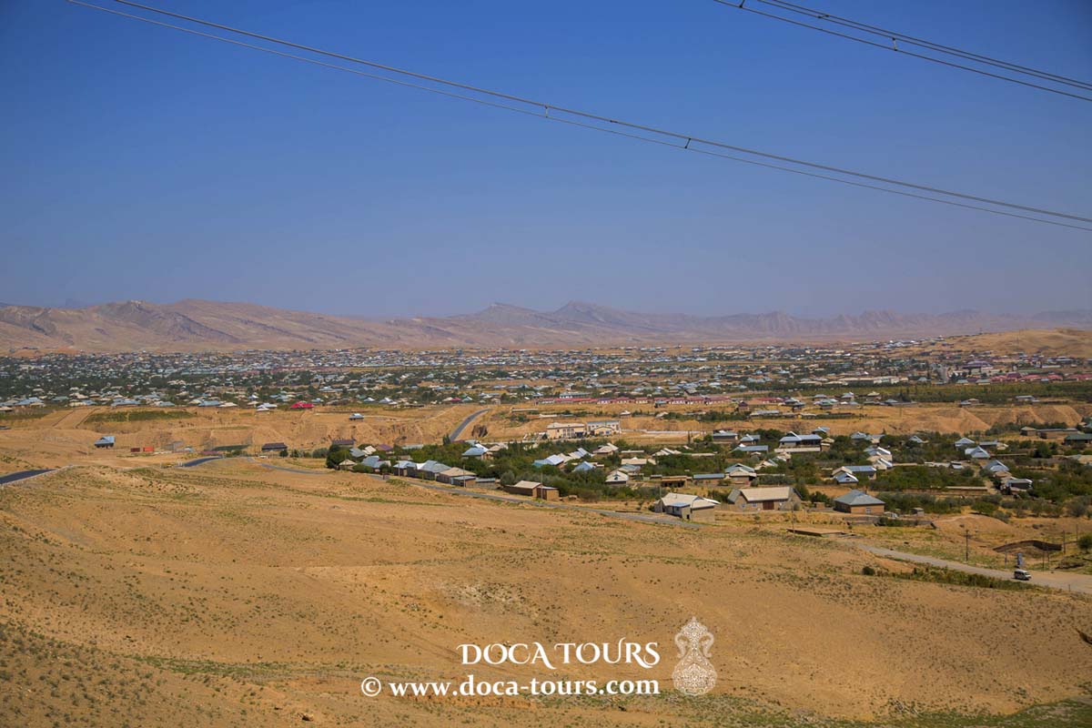
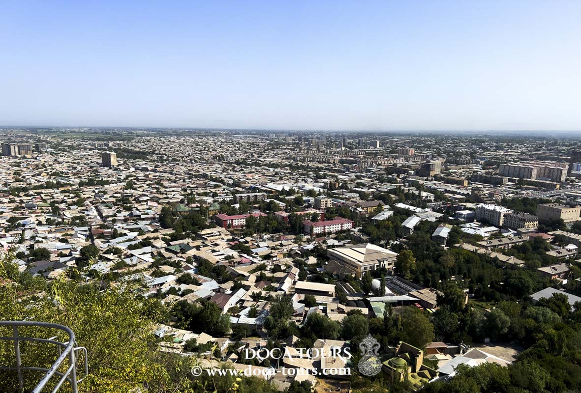
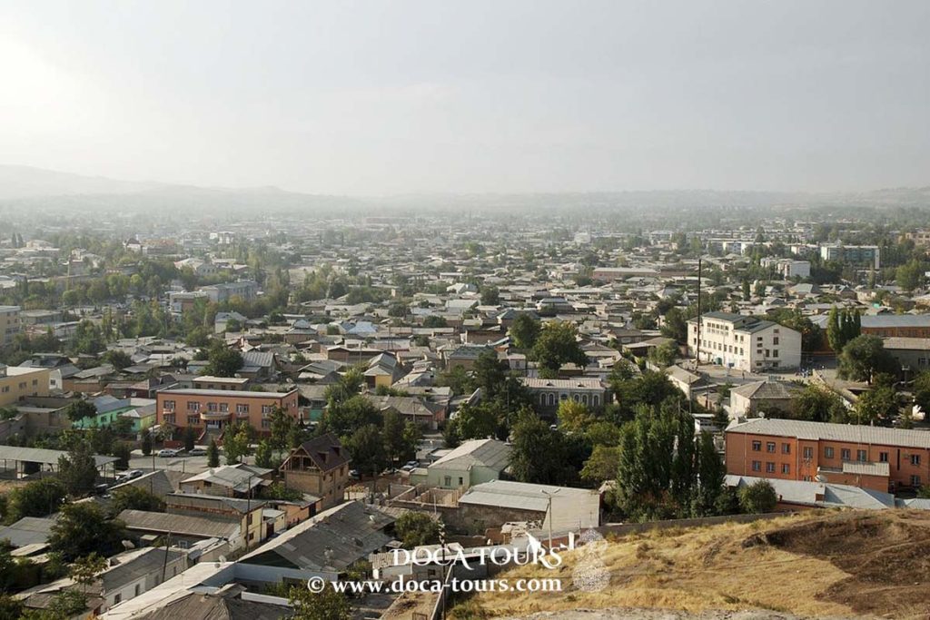
Located in the northern foothills of the Turkestan Range, the city lies 78 kilometers southwest of Khujand, on the main road connecting Tajikistan's two largest cities, Khujand and Dushanbe. Its administrative territory covers 1,830 square kilometers and has a population of 273,500, with 76% residing in remote rural areas.

Istaravshan is one of Central Asia's oldest centers of trade and craftsmanship. In 2002, the city celebrated its 2,500th anniversary. It is one of three proposed locations for ancient Cyropolis, a city built on the northeastern edge of the Achaemenid Empire by King Cyrus in the 6th century BCE.
Location
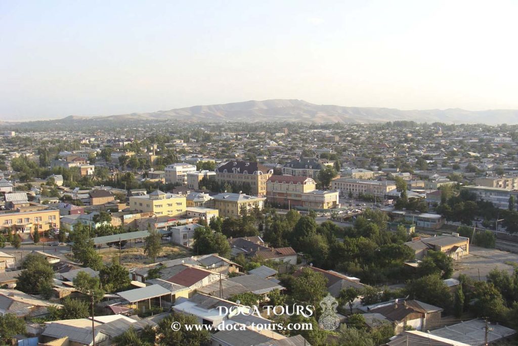
Istaravshan is situated in northern Tajikistan, in the foothills of the Turkestan Range. It is 48 km from the Khavast railway station, 73 km from the regional center, Khujand, and 268 km from Dushanbe.
Geography
At an elevation of 1,140 meters above sea level, Istaravshan spans an area of 900 square kilometers. Located 6 km south of the city is the Kattasoy Reservoir, established in 1965 to supply water and irrigate nearby lands. Its primary water sources are the Basmanda, Kattasoy, and Shahristansoy rivers. The reservoir has a total capacity of 55 million cubic meters, with a maximum depth of 15 meters and a surface area of 298 hectares when full.
History
Istaravshan is often called a "museum city," a historic hub of trade and craftsmanship, and one of Central Asia's oldest cities. In 2002, it marked its 2,500th anniversary.
According to historical and archaeological sources, in the 6th–4th centuries BCE, as crafts and trade flourished in sedentary areas of Central Asia, major urban settlements began to emerge alongside small rural villages.
During this period, cities like Samarkand coexisted with others, including Istaravshan—then known as Cyropolis (Kurushkada), named after Cyrus the Great, founder of the Achaemenid Empire (559–529 BCE). Cyrus established the city in the 6th century BCE, fortifying it with triple walls and a citadel.
Cyropolis thrived due to the growth of trade and craftsmanship. By the time Alexander the Great conquered Central Asia in the 4th century BCE, Kurushkada was already a large, well-fortified city.
From the 2nd to 7th centuries CE, Istaravshan was home to Mug Teppe, an aristocratic settlement known for its impressive castles with distinctive architecture. Archaeological finds, including the fortified sites of Bundzhikat (Kahkaha) and Chilkhudzra, showcase palatial and religious structures adorned with murals and carved panels.
One notable mural discovered in Bundzhikat depicts a she-wolf nursing two infants, symbolizing early cultural exchanges between East and West. Mug Hill, once the residence of local rulers, retains a gateway with a dome and side columns.
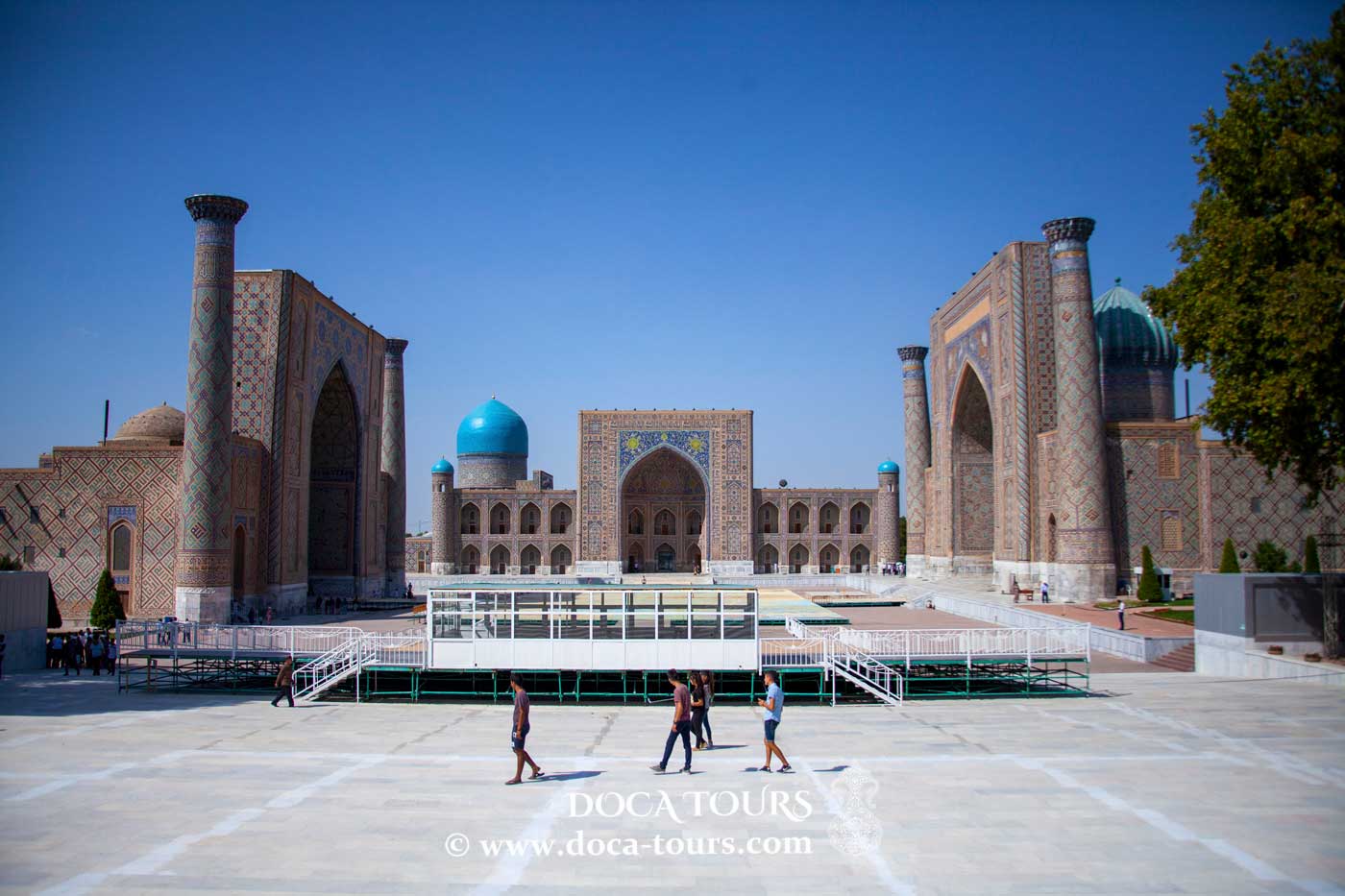
During the Arab rule, Istaravshan became a province of the Arab Caliphate, marked by the construction of Islamic architectural landmarks such as mosques, madrasas, mausoleums, and minarets. The city flourished under the Samanid dynasty (9th–10th centuries).
In the 13th century, the Mongols destroyed the city. Istaravshan experienced a renaissance in the 14th century under the Timurid Empire, during which it was renamed Ura-Tyube. However, in the 16th century, it declined with the rise of the Shaybanid state, which established Bukhara as its capital.
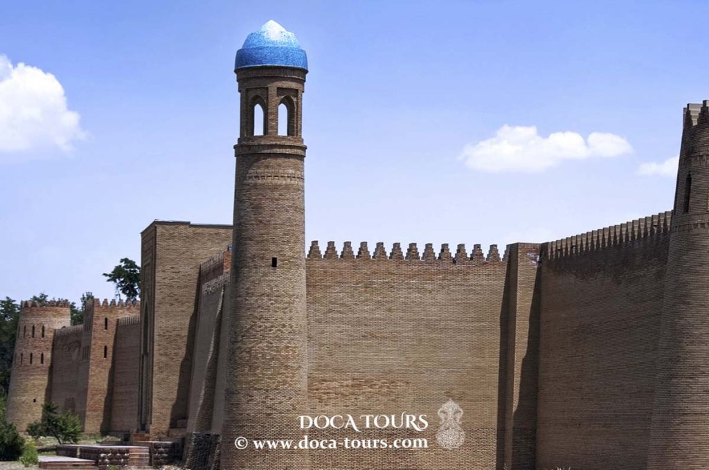
In the 18th century, Ura-Tyube regained prominence, with fortified walls, restored structures, and new buildings constructed to defend against nomadic invasions. The city was captured by Russian forces in 1866.
Notable historical events include the 1861 battle between the Bukhara and Kokand armies near Ura-Tyube, where the Kokand general Alimkul decisively defeated the 18,000-strong Bukharan forces. Subsequently, the fortress was incorporated into the Kokand Khanate.
In 1886, Ura-Tyube became part of the Russian Empire. Today, several historical and architectural monuments reflect the city’s vibrant past.
Archaeological excavations in 1954 uncovered a large triangular slate plate near Ura-Tyube, dating back approximately 100,000 years to the Mousterian period of the Stone Age.
From 1945 to 1947, Ura-Tyube served as the administrative center of the Ura-Tyube region in the Tajik SSR.
Climate
Istaravshan has a continental Mediterranean climate with an average annual temperature of 12.2 °C (54.0 °F). Winters receive more precipitation than summers, with an annual total of about 400 millimeters (16 inches).
Industry
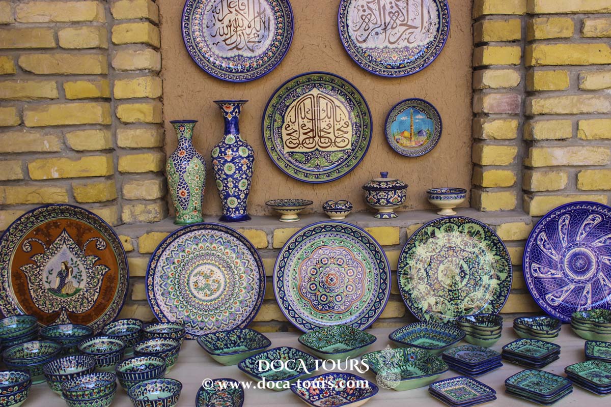
Today, Istaravshan is a significant center for traditional craftsmanship, particularly known for wood carving, pottery, and the production of traditional leather goods. For centuries, the city has been one of three prominent centers of artistic embroidery in the region.
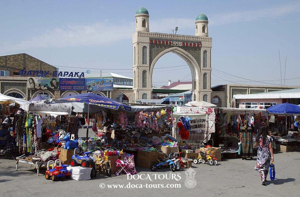
Transport and Tourism
Istaravshan does not have an airport, so road transportation is the primary means of reaching the city. The distance from Dushanbe to Istaravshan is 300 km, while it is 80 km from Khujand, the administrative center of the Sughd Region.
Tourists can enjoy local cuisine at restaurants and teahouses offering traditional dishes such as plov, kurutob, kebabs, beef and lamb shurpa, mastoba, manty, shakarob, sambusa, and more.
Tourist services, including transfers, bookings, guide services, accommodations, and meals, are provided by tourism companies based in Tajikistan, many of which have branches throughout the country.
Landmarks
Mug Teppe Archaeological Site
This unique Achaemenid-era monument showcases distinct architectural and cultural features. It is an archaeological site dating back to the 12th–4th centuries BCE.
Historical and Regional Museum
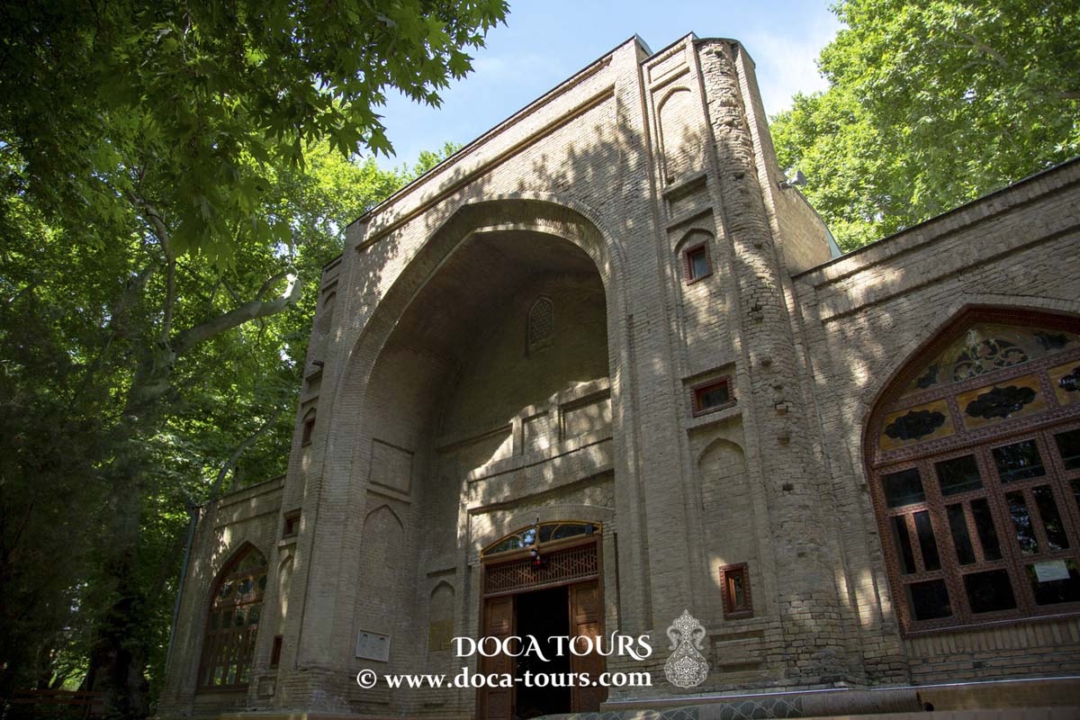
Housed in a former Orthodox church built between 1865 and 1867, the museum preserves one of the city’s earliest brick buildings. Alongside the governor's residence, a school, and other administrative structures, these buildings remain well-preserved and adorn a central area of the city still referred to as the "Russian Quarter" by locals.
Darvoza-Dara Museum
An ethnographic museum housed within the hollow of an ancient tree. It features dozens of exhibits that narrate the history of the region and its people.
Religious Monuments
Hazrati Shokh Ensemble
The Hazrati Shokh ensemble comprises three sacred structures:
- Hazrati Shokh Mausoleum
- Khudoyor Valami Mausoleum
- Namazgoh Mosque
- Mausoleums
Sari Mazor Mausoleum: Built from fired bricks, this structure features a square domed chamber with a cruciform design. The gurkhana (burial chamber) contains a gypsum tombstone.
Ajinahona Mausoleum: Believed to be the resting place of a noblewoman named Bibi-Begimjon, a descendant of Mahdumi Khorazmi.
Chor-Gumbaz Mausoleum: Dating to the late 19th and early 20th centuries. An inscription on one of the wooden ceiling beams reads "1321 Hijri," corresponding to the year 1903.
Abdulqadir Jeloni Mausoleum: Located in an ancient cemetery, this 16th-century architectural monument is a small domed brick structure with a square layout.
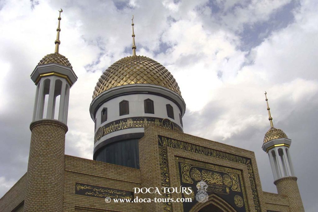
Mosques
Havzi Sangin Mosque: A domed mosque from the 12th–16th centuries, its name translates to "Stone Mosque" because its walls are partially built of stone. It is named after a hauz (water reservoir) with stone-reinforced banks.
Abdulatif Sultan Mosque: Known as "Kok-Gumbaz" or "Blue Dome" due to its color, this mosque is a key landmark of the ancient city.
Bobo-Toga Mosque: An architectural monument from the 16th–19th centuries, this two-chambered portal-domed structure is said to be built over an unknown grave.
Mavlono Usmoni Charkhi Mosque: Located in the Obodi quarter, this 19th-century architectural monument features a square one-columned khanqah, surrounded on three sides by a columned ayvan.
Sister Cities
Krasnoyarsk, Russia (2000)


 Istaravshan is one of Central Asia's oldest centers of trade and craftsmanship. In 2002, the city celebrated its 2,500th anniversary. It is one of three proposed locations for ancient Cyropolis, a city built on the northeastern edge of the Achaemenid Empire by King Cyrus in the 6th century BCE.

 Cyropolis thrived due to the growth of trade and craftsmanship. By the time Alexander the Great conquered Central Asia in the 4th century BCE, Kurushkada was already a large, well-fortified city.
From the 2nd to 7th centuries CE, Istaravshan was home to Mug Teppe, an aristocratic settlement known for its impressive castles with distinctive architecture. Archaeological finds, including the fortified sites of Bundzhikat (Kahkaha) and Chilkhudzra, showcase palatial and religious structures adorned with murals and carved panels.
One notable mural discovered in Bundzhikat depicts a she-wolf nursing two infants, symbolizing early cultural exchanges between East and West. Mug Hill, once the residence of local rulers, retains a gateway with a dome and side columns.
Cyropolis thrived due to the growth of trade and craftsmanship. By the time Alexander the Great conquered Central Asia in the 4th century BCE, Kurushkada was already a large, well-fortified city.
From the 2nd to 7th centuries CE, Istaravshan was home to Mug Teppe, an aristocratic settlement known for its impressive castles with distinctive architecture. Archaeological finds, including the fortified sites of Bundzhikat (Kahkaha) and Chilkhudzra, showcase palatial and religious structures adorned with murals and carved panels.
One notable mural discovered in Bundzhikat depicts a she-wolf nursing two infants, symbolizing early cultural exchanges between East and West. Mug Hill, once the residence of local rulers, retains a gateway with a dome and side columns.
 During the Arab rule, Istaravshan became a province of the Arab Caliphate, marked by the construction of Islamic architectural landmarks such as mosques, madrasas, mausoleums, and minarets. The city flourished under the Samanid dynasty (9th–10th centuries).
In the 13th century, the Mongols destroyed the city. Istaravshan experienced a renaissance in the 14th century under the Timurid Empire, during which it was renamed Ura-Tyube. However, in the 16th century, it declined with the rise of the Shaybanid state, which established Bukhara as its capital.
In the 18th century, Ura-Tyube regained prominence, with fortified walls, restored structures, and new buildings constructed to defend against nomadic invasions. The city was captured by Russian forces in 1866.
Notable historical events include the 1861 battle between the Bukhara and Kokand armies near Ura-Tyube, where the Kokand general Alimkul decisively defeated the 18,000-strong Bukharan forces. Subsequently, the fortress was incorporated into the Kokand Khanate.
During the Arab rule, Istaravshan became a province of the Arab Caliphate, marked by the construction of Islamic architectural landmarks such as mosques, madrasas, mausoleums, and minarets. The city flourished under the Samanid dynasty (9th–10th centuries).
In the 13th century, the Mongols destroyed the city. Istaravshan experienced a renaissance in the 14th century under the Timurid Empire, during which it was renamed Ura-Tyube. However, in the 16th century, it declined with the rise of the Shaybanid state, which established Bukhara as its capital.
In the 18th century, Ura-Tyube regained prominence, with fortified walls, restored structures, and new buildings constructed to defend against nomadic invasions. The city was captured by Russian forces in 1866.
Notable historical events include the 1861 battle between the Bukhara and Kokand armies near Ura-Tyube, where the Kokand general Alimkul decisively defeated the 18,000-strong Bukharan forces. Subsequently, the fortress was incorporated into the Kokand Khanate.
 In 1886, Ura-Tyube became part of the Russian Empire. Today, several historical and architectural monuments reflect the city’s vibrant past.
Archaeological excavations in 1954 uncovered a large triangular slate plate near Ura-Tyube, dating back approximately 100,000 years to the Mousterian period of the Stone Age.
From 1945 to 1947, Ura-Tyube served as the administrative center of the Ura-Tyube region in the Tajik SSR.
In 1886, Ura-Tyube became part of the Russian Empire. Today, several historical and architectural monuments reflect the city’s vibrant past.
Archaeological excavations in 1954 uncovered a large triangular slate plate near Ura-Tyube, dating back approximately 100,000 years to the Mousterian period of the Stone Age.
From 1945 to 1947, Ura-Tyube served as the administrative center of the Ura-Tyube region in the Tajik SSR.