


Video: https://www.youtube.com/watch?v=Pzuetg2vkDc&t=7s
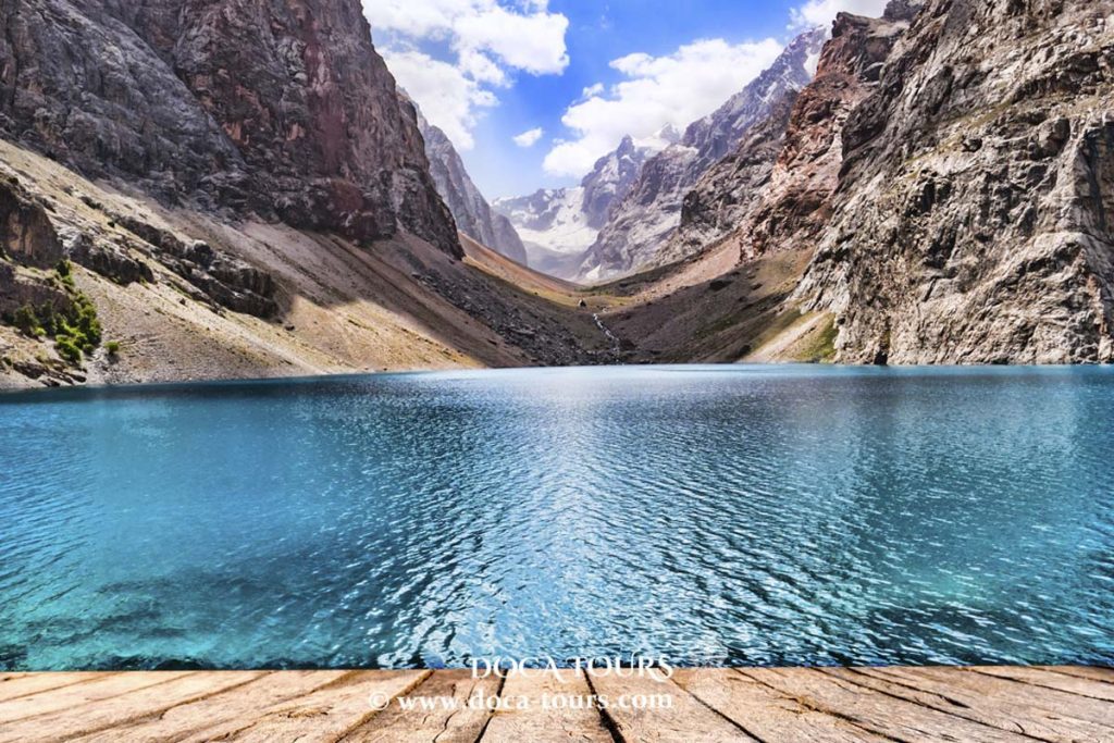
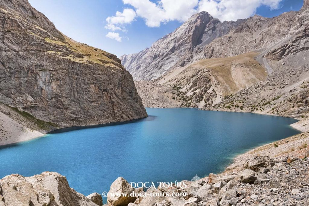
Sarez Lake is considered the most beautiful yet simultaneously the most dangerous body of water in Tajikistan. An earthquake formed it more than a century ago. In November, the British newspaper Daily Mail described the lake as a “ticking time bomb.” According to the United Nations and numerous leading experts, the natural rock and earth dam could collapse at any moment. In the event of a catastrophic breach, the wave height could reach up to 150 metres, affecting residents in four countries. Officially, Dushanbe maintains that there is no cause for concern, as environmental conditions are carefully monitored by specialists. “Izvestia” has investigated the situation in more detail.
In the heart of the Central Asian mountains lies a lake that could unleash its power at any moment. Its waters, cascading downward, would create a destructive flood that could reach the Aral Sea and affect four countries simultaneously.
Just 113 years ago, amidst landslides, destruction, and chaos, Sarez Lake emerged. Born from the depths of the Tajik mountains, it is likely to end its existence as dramatically as it began, ironically mirroring its tumultuous origins.
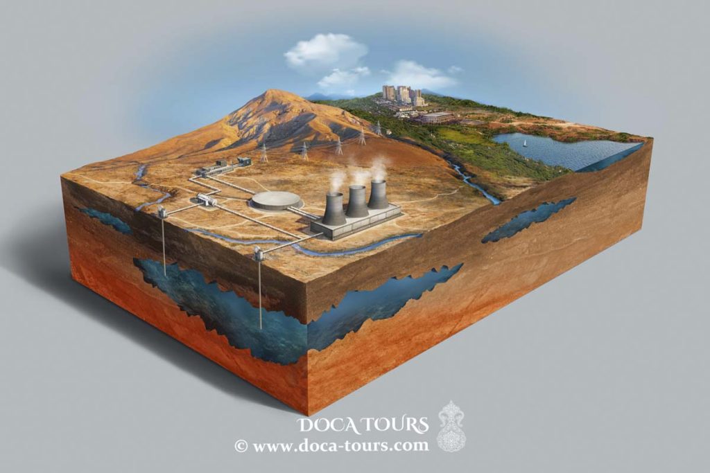
This natural reservoir, confined within a narrow river valley, holds a colossal 17 cubic kilometres of water. Its guardian is a natural dam, 567 metres high, made of soil and rock debris. In the event of a breach, all this water would burst out instantaneously at tremendous speed, causing widespread destruction.
The potential of Sarez Lake was recognised as early as Tsarist Russia and was meticulously studied during the Soviet era. Today, the few inhabitants of the mountain villages know what to do in case of a breach, as the threat from this lake remains significant.
How Sarez Lake Was Born
The mountain river Bartang, fed by the melting snow and glaciers of the Pamirs, meandered like a silver ribbon through a narrow gorge. Under the looming mountains lay two villages—Sarez and Usoy—separated by twenty kilometers. The lake swallowed them.
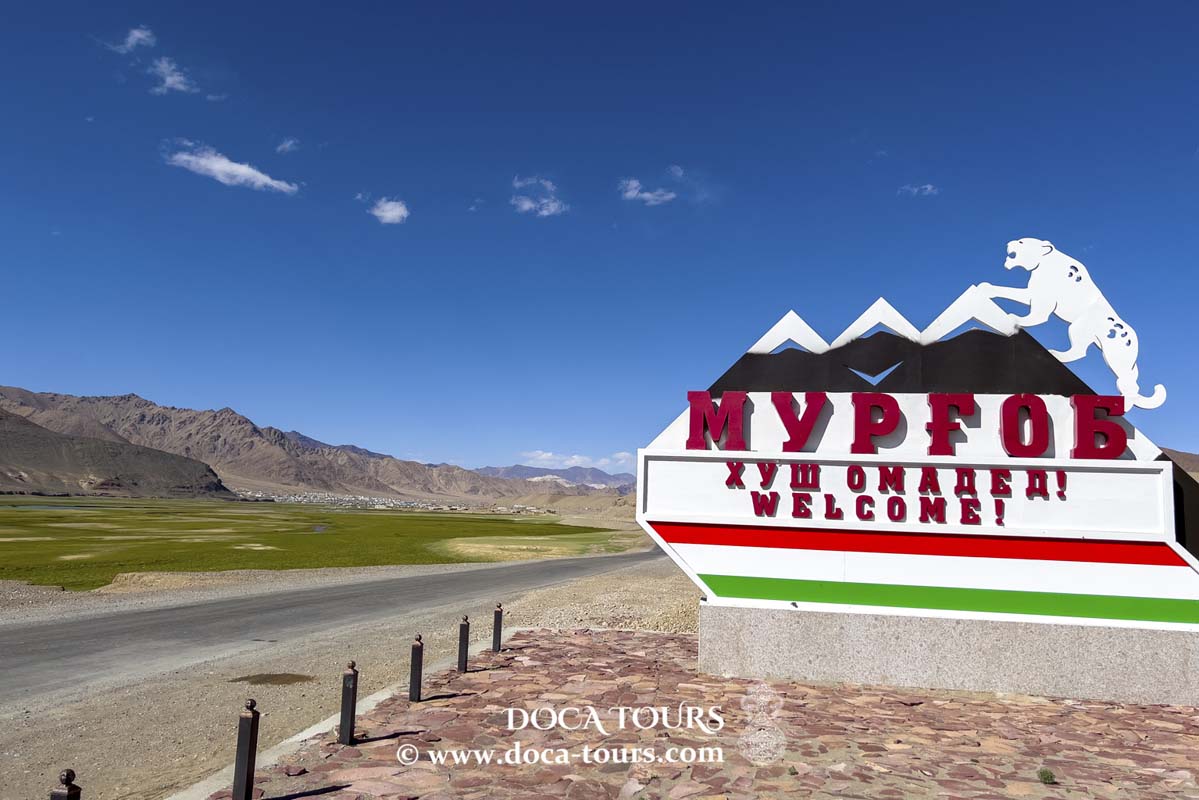
Locally, the upper reaches of the Bartang are called Aksu, and the middle reaches are known as Murghab, which sometimes leads to confusion in various sources.
Late in the evening on February 18, 1911, at 11:31 p.m., people were jolted awake by powerful tremors and a deafening roar. The tectonic plates beneath the Pamirs had begun to shift once more. Even seismographs in St. Petersburg’s Pulkovo Observatory, located 3,800 kilometres away, recorded these vibrations.
On the earthquake intensity scale, this event was rated at 9 out of 12, which is considered “devastating.” The magnitude was measured at 7.4 on the Richter scale.
A cold winter morning arrived. The people of Sarez, who had spent the night in fear and anxiety, woke up to find the familiar crystal-clear high-altitude air replaced by a thick and suffocating dust veil.
We will never know what the inhabitants of Usoy, a village 20 kilometres downstream from Sarez, experienced. Of all its residents, only three survived—those who had visited relatives in Sarez the previous day and stayed the night.
The people hurried to assist their neighbors. As they rounded another steep bend in the valley, they saw a dark mass in the distance. The closer they got, the clearer it became: the village of Usoy had been completely buried under a massive landslide.
Later, scientists would determine that a 2-cubic-kilometre, 6-billion-tonne chunk of the mountain had collapsed. This was enough to completely block the 5-kilometre-wide valley through which the Bartang River flowed. Thus, the world’s highest dam—567 metres tall—was formed, named the Usoy Landslide in memory of the village.
Staff Captain Zaikin, responsible for this part of the Pamirs under the Russian Empire, promptly reached the scene two months later, in April, to assess the aftermath of the devastating earthquake.
He would be unpleasantly surprised: in his report to his superiors, Staff Captain Zaikin would detail the now-destroyed village of Usoy and the gigantic landslide of soil and rock, which he estimated at 650 metres high. He would also mention a small lake that had begun forming as the river, encountering an insurmountable barrier, started accumulating water behind the landslide.
However, Zaikin would be even more astonished in September, when he returned to the area under his responsibility. He would find that the small lake had turned into a large, full-bodied lake. The residents of Sarez, located 20 kilometres above the landslide, were already actively preparing to relocate as the water inexorably approached their village. Their foresight proved correct: by October, the rooftops of the last houses in Sarez were submerged.

Thus, at an altitude of 3,255 metres above sea level, Sarez Lake emerged as a landslide-type lake. Today, it holds a massive volume of water—17 cubic kilometers. The water has filled the river valley in front of the Usoy Landslide, extending 70 kilometres upstream and rising between 185 and 505 meters. The village of Sarez, after which the lake is named, now rests 240 metres below the surface.
The rapid filling of Sarez Lake was completed 15 years after the earthquake, in 1926. Prior to that, its depth increased by 9 metres each year.
It seemed that, at this rate, the water would eventually overflow the landslide. However, nature has a way of balancing itself. Since 1942, the water level has fluctuated but remained generally stable. The water found an escape route; it began seeping through the landslide in small springs. Today, there are 57 such springs.
The news of Sarez Lake’s unprecedented size caused a stir in the scientific community. Researchers immediately began to debate two crucial questions: “Did the earthquake cause the landslide, or was it the other way around?” and “What will happen if the landslide breaches?”
The threat of the natural dam breaking is real and frighteningly unpredictable, as it could happen at any moment. Three possible scenarios are being considered:
Sarez Lake is situated in an area of high seismic activity. On average, earthquakes with a magnitude of 7 occur every 100 years, while earthquakes with magnitudes of 8–9 happen once every 250–2000 years. The energy from such seismic activity is sufficient to destroy the landslide created by the 1911 earthquake.
The natural dam, made of soil and rocks, is also susceptible to erosion from water filtration. Any small stream penetrating the landslide could become a dramatic example of the saying, “Where it’s weak, it breaks!” Complex processes occur here: in some places, the water erodes the dam from within, while in others, leaks are blocked. It’s almost like a living organism whose behaviour is unpredictable, even with the most advanced artificial intelligence.
In 1967, another potential threat was identified: a section on the right bank of the lake was found to be susceptible to landslides. The likelihood of this event is especially high considering the previously mentioned earthquakes. Geologists estimate the volume of loose material in this area to be between 0.5 and 2 cubic kilometres, and if it collapses into the lake, it could trigger a wave that would overflow the landslide and destroy it.
All three scenarios lead to catastrophic consequences. In a grim attempt at humour, one might say that this is the most original way to refill the Aral Sea. In the event of a Sarez Lake breach, the torrents of water, carrying soil and rocks, would rapidly reach the lower reaches of the Amu Darya, causing devastating floods.
The “zone of impact” of Sarez Lake includes areas along the Bartang-Pyanj-Amu Darya river chain, home to 6 million people in Afghanistan, Tajikistan, Turkmenistan, and Uzbekistan. Bartang does not end at Sarez Lake; the water seeping through the landslide continues its journey downstream, creating a potential threat for all who live along its banks.
On the one hand, there are many landslide lakes around the world that remain stable. But Sarez Lake is exceptional in its scale. Moreover, research has shown that at least nine landslide lakes previously existed in this area. Where are they now? They no longer exist. Their landslides were eroded or destroyed. The most recent, Prasarez Lake, is known to us due to its relative “freshness.” Its 4-kilometre dam was partially destroyed by water.
Sarez Lake holds a colossal volume of water, held back by a 567-metre-high dam.
At an altitude of 3,255 metres, in the event of a breach, its flows would plunge down narrow river valleys at immense speed.
The direst forecasts speak of waves up to 120 metres high.
All of this raises the question of how to protect the 6 million people living downstream.
Can Sarez Be Stopped? From a Tunnel to an Observation Post
The grandeur of the Usoy phenomenon makes one ponder the limitations of human efforts.
Captain Grigory Shpilko, one of the first researchers on Sarez Lake
Soviet scientists proposed a well-thought-out plan: constructing a tunnel with a hydroelectric plant to regulate water discharge. This project was appealing in all aspects: monitoring the water level in Sarez Lake, generating electricity for local residents, and providing a steady water supply to arid Central Asia, which constantly struggles with irrigation for cotton.
In 2000, Tajikistan, Uzbekistan, Kyrgyzstan, and Kazakhstan appealed to the international community to engage top experts to address the potential Sarez Lake breach and secure funding. Unfortunately, their efforts did not yield the desired results.
The allocated funding proved as limited as the proposed solution. An observation post was installed on Sarez Lake, designed to send a signal that would activate an alert system in downstream settlements. Sceptics pointed out the underestimated scale of the threat: if the breach turned catastrophic, the post might be washed away before it could send out the alarm.
The funding also allowed for the creation of several rudimentary “safety islands” on surrounding slopes for residents living below Sarez. These islands were stocked with water, food, and essential items. But that was the extent of the solution.
In the event of a significant earthquake, none of these measures would prevent a disaster. Therefore, Sarez Lake remains not only a source of pristine mountain water but also a symbol of the destructive power hidden within our planet.
Stay with us, and you will learn a lot of interesting things!
Thank you very much for your attention.
Subscribe to the channel and don’t forget to like our videos.
#tajikistan, #travel, #background, #freedom, #national, #asia, #tourism, #culture, #holiday, #symbol, #independence, #flag, #country, #nature, #nation, #rock, #tajik, #landscape, #patriotic, #patriotism, #mountain, #day, #valley, #view, #beautiful, #emblem, #sign, #vector, #celebration, #democracy, #scenic, #illustration, #mountains, #adventure, #history, #pamir, #peak, #banner, #hill, #icon, #badakhshan, #independence day, #destination, #state, #asian, #color, #tien shan, #beauty, #stone, #republic